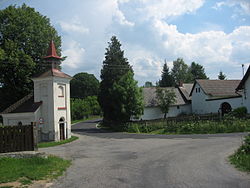
Staré Bříště
Staré Bříště | |
|---|---|
 Chapel of Saint John of Nepomuk | |
| Coordinates: 49°29′27″N 15°21′45″E / 49.49083°N 15.36250°E | |
| Country | |
| Region | Vysočina |
| District | Pelhřimov |
| First mentioned | 1437 |
| Area | |
| • Total | 5.31 km2 (2.05 sq mi) |
| Elevation | 529 m (1,736 ft) |
| Population (2023-01-01)[1] | |
| • Total | 79 |
| • Density | 15/km2 (39/sq mi) |
| Time zone | UTC+1 (CET) |
| • Summer (DST) | UTC+2 (CEST) |
| Postal code | 396 01 |
| Website | www |
Staré Bříště is a municipality and village in Pelhřimov District in the Vysočina Region of the Czech Republic. It has about 80 inhabitants.
Staré Bříště lies approximately 13 kilometres (8 mi) north-east of Pelhřimov, 20 km (12 mi) north-west of Jihlava, and 95 km (59 mi) south-east of Prague.
Administrative parts[edit]
The village of Vlčí Hory is an administrative part of Staré Bříště.
References[edit]
Wikimedia Commons has media related to Staré Bříště.

