Lansdowne Reef
| Disputed island | |
|---|---|
 Lansdowne Reef | |
| Other names | Đá Len Đao (Vietnamese) Pagkakaisa Reef (Philippine English) Bahura ng Pagkakaisa (Filipino) 琼礁 Qióng jiāo(Chinese) |
| Geography | |
| Location | South China Sea |
| Coordinates | 9°46′46″N 114°22′11″E / 9.77944°N 114.36972°E |
| Archipelago | Spratly Islands |
| Administration | |
| District | Trường Sa District |
| Commune | Sinh Tồn Commune |
| Claimed by | |
China | |
Philippines | |
Taiwan | |
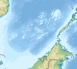
Lansdowne Reef (Filipino: Bahura ng Pagkakaisa); Len Đao Reef (Vietnamese: Đá Len Đao); Mandarin Chinese: 琼礁; pinyin: Qióng jiāo, is a cay on the southern part of the Union Banks of the Spratly Islands in the South China Sea. The island has been occupied by Vietnam since 1988. It is also claimed by China (PRC), the Philippines, Vietnam, and Taiwan (ROC).[1][2][3]
Lansdowne Reef stretches for 3.3 km between its western and northeastern extremities and reaches 900 m along the north-south axis. A tower with a diameter of 15 to 20 meters was built in the center of the reef plain with a diameter of 30 meters.[3]

Chigua Jiao (Johnson South Reef)
Sinh Tồn (Sin Cowe Island)
Dōngmén Jiāo (Hughes Reef)
Sinh Tồn Đông (Grierson Reef/ Sin Cowe East Island)
Đá Len Đao (Landsdowne Reef)
See also[edit]
References[edit]
- ^ (in Vietnamese)Mai Thanh Hai (May 29, 2018). "Những người giữ Len Đao". Thanh Niên. Retrieved December 27, 2022.
- ^ D. J. Hancox; John Robert Victor Prescott (1995). A Geographical Description of the Spratly Islands and an Account of Hydrographic Surveys Amongst Those Islands. IBRU. pp. 11–. ISBN 978-1-897643-18-1.
- ^ a b "Lansdowne Reef". cil.nus.edu.sg. Retrieved 27 December 2022.

