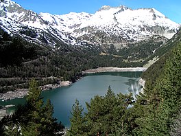
Lac d'Orédon
| Lac d'Orédon | |
|---|---|
 | |
| Location | Hautes-Pyrénées |
| Coordinates | 42°49′32″N 00°09′43″E / 42.82556°N 0.16194°E |
| Type | reservoir |
| Primary inflows | Lac de Cap-de-Long |
| Primary outflows | Neste |
| Basin countries | France |
| Surface area | 0.46 km2 (0.18 sq mi) |
| Surface elevation | 1,849 m (6,066 ft) |
Lac d'Orédon is a lake raised by a dam in Hautes-Pyrénées, France. At an elevation of 1849 m, its surface area is 0.46 km².
It was one of the first lakes of the Pyrenees to have been built in the 17th century.[1]
Public Use[edit]
In 1864, the Ministry of Agriculture decided to increase and regulate the flow of the Neste canal (feeding Gers rivers) using the lakes of the upper valley of Aure (Aubert, Aumar, Cap-de -Long, Lac d'Orédon).[1] The lake was expropriated for public utility in June 1869.[1] Construction of the dam and reservoir was completed in 1884.[1]
References[edit]
- ^ a b c d "Lac d'Orédon - Vallée d'Aure". www.lacsdespyrenees.com. Retrieved 2019-02-01.

