
File:GeneralMapOfDistancesAndHistoricCapitals.jpg
Size of this preview: 744 × 599 pixels. Other resolutions: 298 × 240 pixels | 596 × 480 pixels | 953 × 768 pixels | 1,271 × 1,024 pixels | 2,542 × 2,048 pixels | 3,493 × 2,814 pixels.
Original file (3,493 × 2,814 pixels, file size: 6.14 MB, MIME type: image/jpeg)
| This is a file from the Wikimedia Commons. Information from its description page there is shown below. Commons is a freely licensed media file repository. You can help. |
Summary
Licensing
|
This is a faithful photographic reproduction of a two-dimensional, public domain work of art. The work of art itself is in the public domain for the following reason:
The official position taken by the Wikimedia Foundation is that "faithful reproductions of two-dimensional public domain works of art are public domain".
This photographic reproduction is therefore also considered to be in the public domain in the United States. In other jurisdictions, re-use of this content may be restricted; see Reuse of PD-Art photographs for details. | ||||
File history
Click on a date/time to view the file as it appeared at that time.
| Date/Time | Thumbnail | Dimensions | User | Comment | |
|---|---|---|---|---|---|
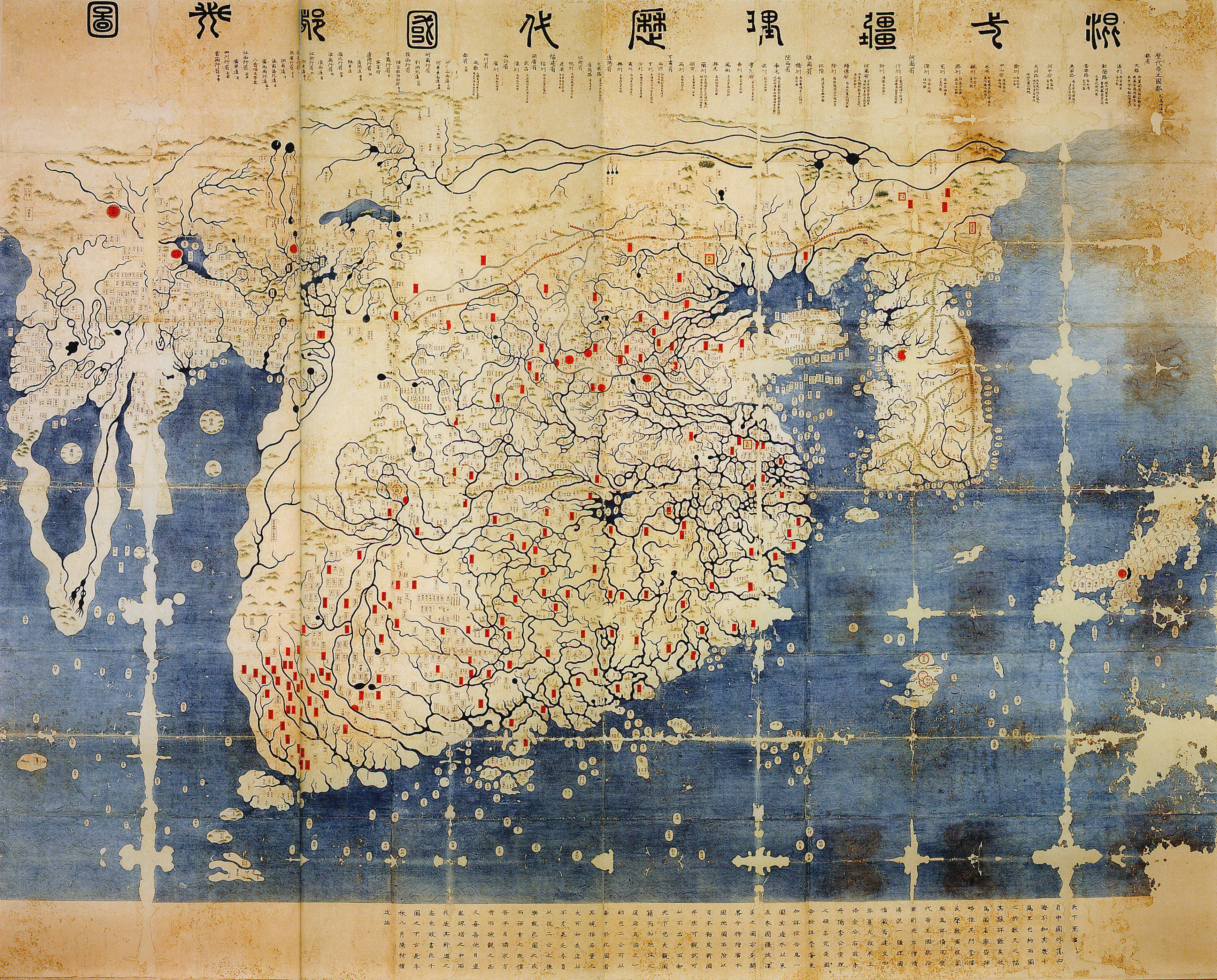
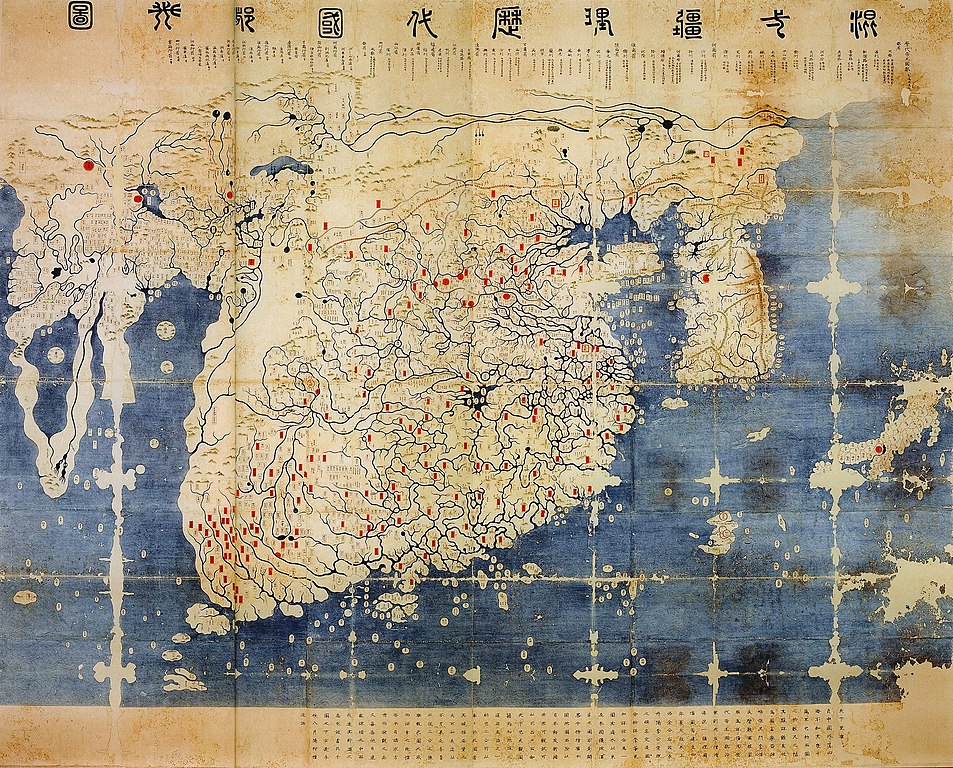
| current | 14:40, 11 June 2008 | | 3,493 × 2,814 (6.14 MB) | Yaan | == Summary == {{Information |Description = General map of the distances and the historic capitals (chinese: Hunyi jiangli lidai guodu zhi tu; japanese: Kon'itsu kyoori rekidai kokuto no zu), Korea, roughly 1470. Ink and paint on paper. Height 220 cm, widt |
File usage
The following pages on the English Wikipedia use this file (pages on other projects are not listed):
Global file usage
The following other wikis use this file:
- Usage on fr.wikipedia.org
- Usage on fr.wikiversity.org
- Usage on ko.wikipedia.org
- Usage on ru.wikipedia.org
- Usage on uk.wikipedia.org
- Usage on www.wikidata.org
- Usage on zh.wikipedia.org