
Bükkzsérc
Bükkzsérc | |
|---|---|
 | |
 Coat of arms | |
 Bükkzsérc Location of Bükkzsérc in Hungary | |
| Coordinates: 47°57′35″N 20°30′03″E / 47.9596°N 20.5009°E | |
| Country | Hungary |
| Region | Northern Hungary |
| County | Borsod-Abaúj-Zemplén |
| Area | |
| • Total | 37.25 km2 (14.38 sq mi) |
| Population (2012)[2] | |
| • Total | 950 |
| • Density | 26/km2 (66/sq mi) |
| Time zone | UTC+1 (CET) |
| • Summer (DST) | UTC+2 (CEST) |
| Postal code | 3414 |
| Area code | +36 49 |
| Website | http://bukkzserc.hu |
Bükkzsérc is a village in Borsod-Abaúj-Zemplén county, Hungary. It is the southern border of Bükk National Park.
History[edit]
The settlement was first mentioned in 1248, as property of the bishopric of Eger. Estate of the Carthusian order in 1457. In 1552 the town was ransacked by the Turks.
Sights[edit]
- Its Catholic church (1776) is a monument.
- In its Calvinist church (1828) there are several extraordinary inner woodcarvings.
- About 30 peasant houses enjoy local protection.
- The exhibition of the Panish Memorial Hall shows the folk life on old photo replicas.
- The first wood carvings of the country picked by a panel of experts are of ancient monument character, we can see them in the Pelyhe Cellar Museum.
- We also have to mention the world war monuments,
- the private hunt trophy collections and
- the horseshoe shaped rocky (natural) formation in the Hódos hill with a diameter of 100 m.
- Within its boundaries we can find the best ground cycling track in the area.
Main events[edit]
- Whit Saturday's Wine Competition
- Village Days in summer
Gallery[edit]
-
 Catholic Church
 -
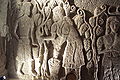 Carvings in a cellar
 -
 Wine cellars in Bükkzsérc


References[edit]
- ^ Bükkzsérc at the Hungarian Central Statistical Office (Hungarian).
- ^ Bükkzsérc at the Hungarian Central Statistical Office (Hungarian). 2012
External links[edit]
- Street map (in Hungarian)
- Official website
- Old photos from Bükkzsérc


This Borsod-Abaúj-Zemplén location article is a stub. You can help Wikipedia by expanding it. |