
File:US Navy 030411-N-0000X-001 A detailed multibeam image for the survey of USS Susan B. Anthony (AP-72).jpg

Size of this preview: 800 × 598 pixels. Other resolutions: 320 × 239 pixels | 640 × 478 pixels | 1,024 × 765 pixels | 1,280 × 956 pixels | 2,104 × 1,572 pixels.
Original file (2,104 × 1,572 pixels, file size: 2.21 MB, MIME type: image/jpeg)
| This is a file from the Wikimedia Commons. Information from its description page there is shown below. Commons is a freely licensed media file repository. You can help. |
Summary
| Description |
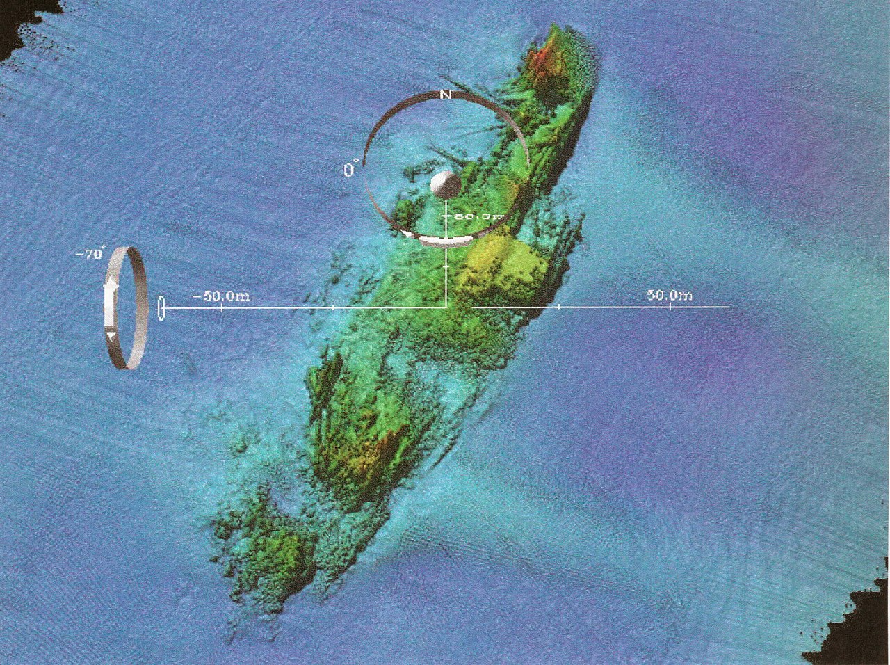
English: Naval Historical Center archeologists have just completed a three-year (2000-200) archeological remote-sensing survey of U.S. Navy shipwreck lost off France’s coastline during the World War II Normandy invasion. The survey focused on locating Navy losses and the temporary harbors used in Neptune, the naval portion of Operation Overlord, codename for the Allied invasion of Europe, (D-Day), June 6, 1944. Cooperative effort between the Naval Historical Center, RESON (an off shore technology company), FUGRO (a company that makes navigation products), and the Center for Coastal and Ocean Mapping and Joint Hydrographic Center (CCOM) produced very detailed multibeam images for the survey such as this overview of the USS Susan B. Anthony (AP-72). The Susan B. Anthony, a troop transport, struck a sea-mine and san on June 7, 1944. The booms and damage to the number one hole (at the bow) are easy to see in this image. U. S. Navy photo. |
|||
| Date | Taken on 11 April 2003 | |||
| Source |
|
|||
| Author | U.S. Navy photo |

.jpg)
Licensing
This file is a work of a sailor or employee of the U.S. Navy, taken or made as part of that person's official duties. As a work of the U.S. federal government, it is in the public domain in the United States.
|
 | |
| This file has been identified as being free of known restrictions under copyright law, including all related and neighboring rights. | ||
File history
Click on a date/time to view the file as it appeared at that time.
| Date/Time | Thumbnail | Dimensions | User | Comment | |
|---|---|---|---|---|---|
| current | 07:42, 22 October 2009 | | 2,104 × 1,572 (2.21 MB) | BotMultichillT | == {{int:filedesc}} == {{Information |description={{en|1=Washington, D.C. (Apr. 11, 2003) -- Naval Historical Center archeologists have just completed a three-year (2000-200) archeological remote-sensing survey of U.S. Navy shipwreck lost off France&rsquo |
File usage
The following pages on the English Wikipedia use this file (pages on other projects are not listed):
Global file usage
The following other wikis use this file:
- Usage on es.wikipedia.org
- Usage on et.wikipedia.org
- Usage on ja.wikipedia.org
- Usage on zh.wikipedia.org
.jpg)