
File:Bonnielandfall.gif
No higher resolution available.
Bonnielandfall.gif (773 × 455 pixels, file size: 4.73 MB, MIME type: image/gif, looped, 144 frames, 37 s)
| This is a file from the Wikimedia Commons. Information from its description page there is shown below. Commons is a freely licensed media file repository. You can help. |
Summary
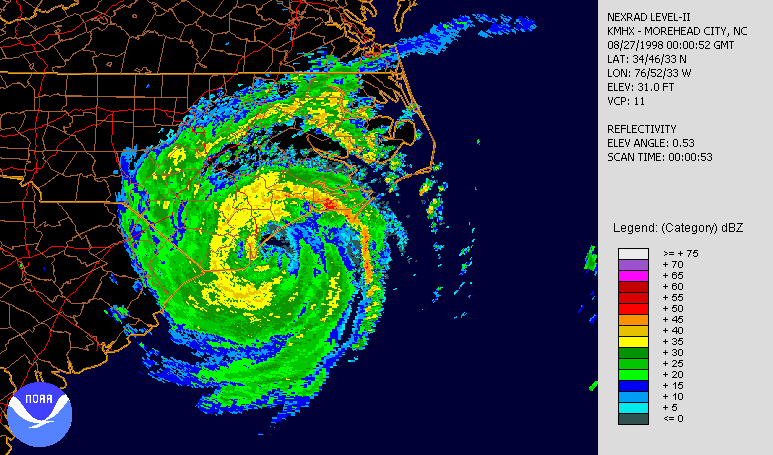
| Description | A radar loop of Hurricane Bonnie at landfall. Note how the land disrupts the storm, with the heavier precipitation over water; made using JAVA NEXRAD tool. | |||
| Date | ||||
| Source | NCDC NEXRAD database | |||
| Author | NOAA | |||
| Permission (Reusing this file) |
|
File history
Click on a date/time to view the file as it appeared at that time.
| Date/Time | Thumbnail | Dimensions | User | Comment | |
|---|---|---|---|---|---|
| current | 00:25, 13 April 2007 | | 773 × 455 (4.73 MB) | Clamity21 | {{Information |Description=A radar loop of Hurricane Bonnie at landfall. Note how the land disrupts the storm, with the heavier precepitation over water; made using [http://www.ncdc.noaa.gov/oa/radar/jnx/ JAVA NEXRAD tool]. |Source=[http://www.ncdc.noaa.g |
File usage
The following pages on the English Wikipedia use this file (pages on other projects are not listed):
Global file usage
The following other wikis use this file:
- Usage on fr.wikipedia.org