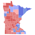
File:2018 Minnesota gubernatorial election results map by county.svg

Page contents not supported in other languages.
This is a file from the Wikimedia Commons
From Wikipedia, the free encyclopedia

Original file(SVG file, nominally 810 × 810 pixels, file size: 46 KB)

Summary

Description

Results of the Minnesota gubernatorial election, 2018
Johnson

 
40-50%
 
50-60%
 
60-70%

Tie

 
40-50%

Walz

 
40-50%
 
50–60%
 
60–70%
Date 7 November 2018 (upload date)
Source

Based on File:2000nationwidecountymapshadedbyvoteshare.svg by Inqvisitor; data from OurCampaigns.com and USElectionAtlas.org

 
This W3C-unspecified vector image was created with Inkscape .
Author
Permission
(Reusing this file)
Public domain I, the copyright holder of this work, release this work into the public domain. This applies worldwide.
In some countries this may not be legally possible; if so:
I grant anyone the right to use this work for any purpose, without any conditions, unless such conditions are required by law.

Licensing

I, the copyright holder of this work, hereby publish it under the following license:
w:en:Creative Commons
attribution share alike
This file is licensed under the Creative Commons Attribution-Share Alike 4.0 International license.
You are free:
  • to share – to copy, distribute and transmit the work
  • to remix – to adapt the work
Under the following conditions:
  • attribution – You must give appropriate credit, provide a link to the license, and indicate if changes were made. You may do so in any reasonable manner, but not in any way that suggests the licensor endorses you or your use.
  • share alike – If you remix, transform, or build upon the material, you must distribute your contributions under the same or compatible license as the original.

Captions

Add a one-line explanation of what this file represents

Items portrayed in this file

depicts

image/svg+xml

b7accef2275f7b0b193d873e1ab37f375b51567e

635,834 byte

744 pixel

744 pixel

File history

Click on a date/time to view the file as it appeared at that time.

Date/TimeThumbnailDimensionsUserComment
current23:55, 12 February 2024Thumbnail for version as of 23:55, 12 February 2024810 × 810 (46 KB)Putitonamap98shapes
03:01, 3 July 2023Thumbnail for version as of 03:01, 3 July 2023744 × 744 (353 KB)Putitonamap98removed left over map in file to save on memory
04:11, 6 December 2022Thumbnail for version as of 04:11, 6 December 2022744 × 744 (621 KB)SpeedMcCoolnew shapes
17:20, 4 December 2018Thumbnail for version as of 17:20, 4 December 2018512 × 574 (39 KB)Pharexiachanged grey (indicative of incomplete results) with light purple (commonly used as legend for tie between GOP and Democrat)
21:04, 2 December 2018Thumbnail for version as of 21:04, 2 December 2018289 × 324 (1.08 MB)SpeedMcCoolUpdated with current results
16:01, 13 November 2018Thumbnail for version as of 16:01, 13 November 2018289 × 324 (1.08 MB)SpeedMcCoolOriginal color scheme and borders are more correct and match previous maps
02:50, 13 November 2018Thumbnail for version as of 02:50, 13 November 2018512 × 574 (24 KB)Pharexiachanged colors and outline
16:08, 7 November 2018Thumbnail for version as of 16:08, 7 November 2018289 × 324 (1.08 MB)SpeedMcCoolUser created page with UploadWizard
The following pages on the English Wikipedia use this file (pages on other projects are not listed):

Metadata