
Sunnynook, New Zealand
Sunnynook | |
|---|---|
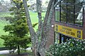
 Sunnynook Shopping Centre | |
 | |
| Coordinates: 36°45′18″S 174°44′13″E / 36.755°S 174.737°E | |
| Country | New Zealand |
| City | Auckland |
| Local authority | Auckland Council |
| Electoral ward | North Shore ward |
| Local board | Devonport-Takapuna Local Board |
| Area | |
| • Land | 155 ha (383 acres) |
| Population (June 2023)[2] | |
| • Total | 5,770 |
| Postcode(s) | 0620 |
| Busway stations | Sunnynook busway station |
| Rosedale | Mairangi Bay | Campbells Bay |
| Totara Vale |
|
Castor Bay |
| Glenfield | Wairau Valley | Forrest Hill |
Sunnynook is a suburb on the North Shore in the Auckland metropolitan area in New Zealand. It is currently under the governance of Auckland Council.
The suburb is centred on the Sunnynook Shopping Centre and the nearby Sunnynook Park. A skateboard bowl is located in the park, which is also home to the Glenfield Greyhounds rugby league club. Sunnynook residents have access to the Northern Busway rapid transit bus link via the Sunnynook busway station.
Demographics[edit]
Sunnynook covers 1.55 km2 (0.60 sq mi)[1] and had an estimated population of 5,770 as of June 2023,[2] with a population density of 3,747 people per km2.
| Year | Pop. | ±% p.a. |
|---|---|---|
| 2006 | 5,034 | — |
| 2013 | 5,121 | +0.25% |
| 2018 | 5,538 | +1.58% |
| Source: [3] | ||
Sunnynook had a population of 5,538 at the 2018 New Zealand census, an increase of 417 people (8.1%) since the 2013 census, and an increase of 504 people (10.0%) since the 2006 census. There were 1,734 households, comprising 2,769 males and 2,772 females, giving a sex ratio of 1.0 males per female, with 1,116 people (20.2%) aged under 15 years, 1,353 (24.4%) aged 15 to 29, 2,616 (47.2%) aged 30 to 64, and 450 (8.1%) aged 65 or older.
Ethnicities were 45.2% European/Pākehā, 6.0% Māori, 3.8% Pacific peoples, 49.2% Asian, and 4.8% other ethnicities. People may identify with more than one ethnicity.
The percentage of people born overseas was 57.6, compared with 27.1% nationally.
Although some people chose not to answer the census's question about religious affiliation, 46.2% had no religion, 38.3% were Christian, 0.2% had Māori religious beliefs, 3.5% were Hindu, 2.4% were Muslim, 2.1% were Buddhist and 2.1% had other religions.
Of those at least 15 years old, 1,569 (35.5%) people had a bachelor's or higher degree, and 390 (8.8%) people had no formal qualifications. 717 people (16.2%) earned over $70,000 compared to 17.2% nationally. The employment status of those at least 15 was that 2,358 (53.3%) people were employed full-time, 651 (14.7%) were part-time, and 195 (4.4%) were unemployed.[3]
| Name | Area (km2) | Population | Density (per km2) | Households | Median age | Median income |
|---|---|---|---|---|---|---|
| Sunnynook South | 0.80 | 2,673 | 3,341 | 831 | 33.1 years | $31,300[4] |
| Sunnynook North | 0.74 | 2,865 | 3,872 | 903 | 33.5 years | $34,200[5] |
| New Zealand | 37.4 years | $31,800 |
Education[edit]
- Wairau Intermediate is an intermediate (years 7–8) school with a roll of 342 students as of February 2024.[6][7] It opened in 1980.[8]
- Sunnynook Primary School is a contributing primary (years 1–6) school with a roll of 447 students as of February 2024.[6][9] It opened in 1968.[10] Both schools are coeducational.
Gallery[edit]
-
 Playing sports on Sunnynook Park
 -
 Sunnynook Scout Den on the edge of Sunnynook Park
 -
 Sunnynook Park on a warm Spring morning


Notes[edit]
- ^ a b "ArcGIS Web Application". statsnz.maps.arcgis.com. Retrieved 21 December 2023.
- ^ a b "Population estimate tables - NZ.Stat". Statistics New Zealand. Retrieved 25 October 2023.
- ^ a b "Statistical area 1 dataset for 2018 Census". Statistics New Zealand. March 2020. Sunnynook South (121200) and Sunnynook North (121300).
- ^ 2018 Census place summary: Sunnynook South
- ^ 2018 Census place summary: Sunnynook North
- ^ a b "New Zealand Schools Directory". New Zealand Ministry of Education. Retrieved 14 March 2024.
- ^ Education Counts: Wairau Intermediate
- ^ "Our History". Wairau Intermediate. Archived from the original on 1 April 2007. Retrieved 8 February 2009.
- ^ Education Counts: Sunnynook School
- ^ "Calling all pupils". North Shore Times Advertiser. 26 February 1993. p. 9. Retrieved 18 April 2024.