
Sławienko, Silesian Voivodeship
Sławienko | |
|---|---|
Village | |
 Village chapell | |
 Sławienko | |
| Coordinates: 50°8′56″N 18°6′29″E / 50.14889°N 18.10806°E | |
| Country | |
| Voivodeship | Silesian |
| County | Racibórz |
| Gmina | Rudnik |
Sławienko [swaˈvjɛnkɔ] (German Ehrenfeld) is a village in the administrative district of Gmina Rudnik, within Racibórz County, Silesian Voivodeship, in southern Poland.[1] It lies approximately 6 kilometres (4 mi) north-west of Rudnik, 12 km (7 mi) north-west of Racibórz, and 65 km (40 mi) west of the regional capital Katowice.
Gallery[edit]
-
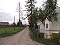 Street
 -
 House
House -
 Fields
,_silnice.jpg)
,_d%C5%AFm.jpg)
,_cesta.jpg)
References[edit]
Wikimedia Commons has media related to Sławienko, Silesian Voivodeship.
| Seat | _COA.svg) | |
|---|---|---|
| Other villages | ||
This Racibórz County location article is a stub. You can help Wikipedia by expanding it. |