
Ruddels Mills, Kentucky

Ruddels Mills is an unincorporated community in Bourbon County, Kentucky.[1] It was established by Captain Isaac Ruddell as a mill.[2] The site is located where Hinkston Creek and Stoner Creek join to form the South Fork of the Licking River (not to be confused with Ruddles Station).
References[edit]
- ^ U.S. Geological Survey Geographic Names Information System: Ruddels Mills, Kentucky
- ^ "Ruddells Mills". www.uky.edu. Retrieved March 7, 2013.
External links[edit]
Municipalities and communities of Bourbon County, Kentucky, United States | ||
|---|---|---|
| Cities | 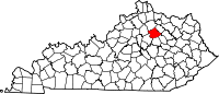 | |
| Unincorporated communities | ||
38°18′15″N 84°14′17″W / 38.30417°N 84.23806°W
This Bourbon County, Kentucky state location article is a stub. You can help Wikipedia by expanding it. |