
Rizal (province)
Rizal | |
|---|---|
| Province of Rizal | |
(from top: left to right) Rizal Provincial Capitol, Masungi Georeserve, Hinulugang Taktak, Pililla Wind Farm, Angono Petroglyphs and Sierra Madre Mountains in Tanay. | |
 Flag  Seal | |
| Anthem: Rizal Mabuhay | |
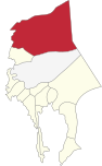
 Location in the Philippines | |
OpenStreetMap  | |
| Coordinates: 14°40′N 121°15′E / 14.67°N 121.25°E | |
| Country | Philippines |
| Region | Calabarzon |
| Founded | June 11, 1901 |
| Named for | José Rizal |
| Capital and largest city | Antipolo (since July 7, 2020) |
| Government | |
| • Type | Sangguniang Panlalawigan |
| • Governor | Nina Ricci A. Ynares (NPC) |
| • Vice Governor | Reynaldo H. San Juan, Jr. (PFP) |
| • Legislature | Rizal Provincial Board |
| Area | |
| • Total | 1,191.94 km2 (460.21 sq mi) |
| • Rank | 73rd out of 81 |
| Highest elevation | 1,509 m (4,951 ft) |
| Population (2020 census)[2] | |
| • Total | 3,330,143 |
| • Rank | 4th out of 81 |
| • Density | 2,800/km2 (7,200/sq mi) |
| • Rank | 1st out of 81 |
| Demonym | Rizaleño |
| Divisions | |
| • Independent cities | 0 |
| • Component cities | 1 |
| • Municipalities | |
| • Barangays | 189 |
| • Districts | |
| Demographics | |
| • Ethnic groups | |
| • Languages | |
| Time zone | UTC+8 (PST) |
| ZIP code | 1850–1990 |
| IDD : area code | +63 (0)2 |
| ISO 3166 code | PH-RIZ |
| Website | rizalprovince |


(2019-01-20).JPG)


Rizal, officially the Province of Rizal (Filipino: Lalawigan ng Rizal), is a province in the Philippines located in the Calabarzon region in Luzon. Its capital is the city of Antipolo. It is about 16 kilometers (9.9 mi) east of Manila. The province is named after José Rizal, one of the main national heroes of the Philippines. It is bordered by Metro Manila to the west, Bulacan to the north, Quezon to the east and Laguna to the southeast. The province also lies on the northern shores of Laguna de Bay, the largest lake in the country. Rizal is a mountainous province perched on the western slopes of the southern portion of the Sierra Madre mountain range.
Antipolo serves as the provincial capital since 2020, having been an administrative center since 2009 with the capitol located in the city. Previously, Pasig served as the capital, a designation it retained even after becoming part of the National Capital Region in 1975.[4][5]
The province is a part of Greater Manila Area. It is the 5th largest province in the Philippines in terms of population.
History[edit]
Early history[edit]
Tagalog settlement arrived some time in the pre-Spanish period. The provincial territory began with the organization of the Tondo and Laguna provinces during the Spanish administration. Some of the towns like Pasig, Parañaque, Taytay and Cainta were already thriving.
Spanish colonial era[edit]
From the reports of the Encomiendas in 1582–1583, the Encomiendas of Moron (Morong) was under the jurisdiction of La Laguna and, the Encomiendas of Passi (Pasig), Taitay (Taytay) and Tagui (Taguig) belonged to the Province of Tondo. It was recorded that in 1591, the Encomiendas of Moron and Taitay were under the jurisdiction of the Franciscan Order in the Province of La Laguna; and the Encomiendas of Nabotas (Navotas), Tambobo (Malabon), Tondo, Parañaque (then La Huerta, Parañaque), Longalo (Don Galo, Parañaque), Tagui and Pasig were under the jurisdiction of the Augustinians in the Province of Tondo.
In 1853, a new political subdivision named Distrito Politico-Militar de los Montes de San Mateo (transl. Political-Military District of the San Mateo Mountains) was formed.[6] This consisted of the towns of Antipolo, Bosoboso, Cainta and Taytay from the Province of Tondo; and the towns of Morong, Baras, Tanay, Pililla, Angono, Binangonan and Jala-jala from the Province of La Laguna, with the capital at Morong. This district was changed to Distrito Politico-Militar de Morong four years later.[7]
By virtue of Circular No. 83, dated September 2, 1859, the Province of Tondo became the Province of Manila. All its towns were placed under the administration, fiscal supervision and control of the Governor of the new province.
The town of Mariquina (Marikina) became the capital of the Province of Manila during the tenure of the revolutionary government of Gen. Emilio Aguinaldo. The Politico-Military District of Morong had for its capital the town of Antipolo from 1898 to 1899 and the town of Tanay from 1899 to 1900.
American invasion era[edit]
Foundation[edit]
_map_09.jpg)
On February 6, the First Philippine Commission sought to establish civil government in the country through a provincial organization act after the Filipino-Spanish and Filipino-American conflicts.
Therefore, on June 5, 1901, a historic meeting was held at the Pasig Catholic Church for the organization of a civil government in the Province of Manila and District of Morong, with 221 delegates in attendance.[8] The first Philippine Commission, headed by William Howard Taft and composed of Commissioners Luke E. Wright, Henry C. Ide, Bernard Moses and Dean C. Worcester, discussed with the Assembly the issue of whether or not to write the Province of Manila with the District of Morong, was not self-sufficient to operate as a separate province.
Although the delegates from Morong, Hilarion Raymundo, and José Tupas, objected to the proposal, Juan Sumulong of Antipolo strongly advocated the move. After much acrimonious debate and upon the suggestion of Trinidad H. Pardo de Tavera the body agreed on the creation of a new province independent of the Province of Manila. The new province was aptly named after José Rizal, the country's national hero.
_Old_Capitol.jpg)
On June 11, 1901, the province of Rizal was officially and legally created by virtue of Act No. 137 by the First Philippine Commission which during the time was acting as the unicameral legislative body in the island of Luzon.[10]
The new province was composed of 32 municipalities, 19 from the old Province of Manila (i.e. Cainta, Caloocan, Las Piñas, Malibay, Mariquina (Marikina), Montalban (Rodriguez), Muntinlupa, Navotas, Novaliches, Parañaque, Pasig, Pateros, Pineda (Pasay), San Felipe Neri (Mandaluyong), San Juan del Monte (San Juan), San Mateo, San Pedro Macati (Makati), Taguig, Tambobong (Malabon)); and 13 from the Politico-Military District of Morong (i.e. Angono, Antipolo, Baras, Binangonan, Bosoboso, Cardona, Jalajala, Morong, Pililla, Quisao, Tanay, Taytay and Teresa).[11] The City of Manila from the old Province of Manila was treated as a separate entity. The seat of the provincial government was Pasig; however, for seven months in 1904, San Felipe Neri served as the provincial seat.[12]
The number of municipalities changed with the municipal boundaries through time, mostly occurring within the provincial boundary.[13][14][15][16] On October 12, 1903, the former municipalities of Bosoboso, Malibay, Novaliches and Quisao were absorbed by Antipolo, Pasay, Caloocan and Pililla, respectively, by virtue of Act No. 942.[11] On November 25, 1903, Muntinlupa was ceded to the Province of La Laguna and became part of the municipality of Biñan,[17] but was later returned to Rizal on March 22, 1905, and became part of Taguig until December 17, 1917.[18][19]
.svg)
On October 12, 1939, Quezon City was established,[20] which included parts of Caloocan, and later on, Novaliches and parts of Marikina, Pasig and San Juan.
Japanese occupation era[edit]
Marking's and the Hunter's ROTC Guerrillas operated in Rizal Province throughout the war.[21][22]
In 1942, Quezon City and the towns of Caloocan, Makati, Mandaluyong, Parañaque, Pasay, and San Juan were merged with Manila to form the City of Greater Manila, by virtue of Executive Order No. 400 signed by President Manuel L. Quezon as an emergency measure.[23] The city was dissolved by President Sergio Osmeña in 1945, thus restoring the pre-war status of the merged cities and towns.[24][25]
Philippine independence[edit]

Through Presidential Decree No. 824, Rizal was partitioned on November 7, 1975 to form Metropolitan Manila. The municipalities of Las Piñas, Parañaque, Muntinlupa, Taguig, Pateros, Makati, Mandaluyong, San Juan, Malabon, Navotas, Pasig and Marikina, and the three cities of Caloocan, Pasay and Quezon City were excised to form the new region, while the other 14 towns remained in Rizal.[27]
Contemporary[edit]
On June 17, 2008, Governor Casimiro Ynares III announced the transfer of the provincial capitol from Pasig to Antipolo. The new ₱270-million capitol building, constructed by Ortigas & Co., owner thereof, was completed by December of that year. Built on a 5-hectare (12-acre) lot near the Ynares Center,[28] it was successfully inaugurated on March 4, 2009, bringing back the Capitol Building inside the provincial territory from which it was absent for 34 years (when Pasig was incorporated into Metro Manila).
On June 19, 2020, President Rodrigo Duterte signed Republic Act No. 11475 into law, which officially transferred the capital of the Rizal province from Pasig to Antipolo. The law was published on June 22, 2020, and took effect on July 7, 2020. The publication of the law coincided with the 159th birth anniversary of Rizal.
Geography[edit]
Rizal covers a total area of 1,182.65 square kilometers (456.62 sq mi)[29] occupying the northern-central section of the Calabarzon in Luzon. The province is bordered on the north by Bulacan, east by Quezon, southeast by Laguna, south by Laguna de Bay, and west by Metro Manila.
Located 20 kilometers (12 mi) east of Manila, commuters take approximately an hour to reach the provincial seat which is in Antipolo. Generally hilly and mountainous in terrain, most of the province's southern towns lie in the shores of Laguna de Bay, the country's largest inland body of water.[1]
Talim Island, the largest island situated within Laguna de Bay, is under the jurisdiction of the province.


Climate[edit]
| Climate data for Rizal | |||||||||||||
|---|---|---|---|---|---|---|---|---|---|---|---|---|---|
| Month | Jan | Feb | Mar | Apr | May | Jun | Jul | Aug | Sep | Oct | Nov | Dec | Year |
| Mean daily maximum °C (°F) | 30.5 (86.9) |
31.5 (88.7) |
33.1 (91.6) |
34.5 (94.1) |
34.0 (93.2) |
32.6 (90.7) |
32.0 (89.6) |
31.2 (88.2) |
31.4 (88.5) |
31.6 (88.9) |
31.4 (88.5) |
30.5 (86.9) |
32.0 (89.7) |
| Mean daily minimum °C (°F) | 21.6 (70.9) |
21.8 (71.2) |
22.9 (73.2) |
24.1 (75.4) |
25.0 (77.0) |
25.0 (77.0) |
24.6 (76.3) |
24.8 (76.6) |
24.3 (75.7) |
24.0 (75.2) |
23.5 (74.3) |
22.3 (72.1) |
23.7 (74.6) |
| Average rainy days | 5 | 3 | 4 | 5 | 13 | 20 | 22 | 22 | 22 | 17 | 15 | 8 | 156 |
| Source: Storm247 [30] | |||||||||||||
Administrative divisions[edit]
Rizal comprises 13 municipalities and 1 city.[29]

- † Provincial capital and component city
- Municipality
| |||||||||||||||||||||||||||||||||||||||||||||||||||||||||||||||||||||||||||||||||||||||||||||||||||||||||||||||||||||||||||||||||||||||||||||||||||||||||||||||||||||||||||||||||||||||||||||||||||||||||||||||||||||||||||||||||||||||||||||||||||
Demographics[edit]
| Year | Pop. | ±% p.a. |
|---|---|---|
| 1903 | 50,095 | — |
| 1918 | 63,719 | +1.62% |
| 1939 | 87,876 | +1.54% |
| 1948 | 104,578 | +1.95% |
| 1960 | 173,958 | +4.33% |
| 1970 | 307,238 | +5.85% |
| 1975 | 414,192 | +6.17% |
| 1980 | 555,533 | +6.05% |
| 1990 | 977,448 | +5.81% |
| 1995 | 1,312,489 | +5.68% |
| 2000 | 1,707,218 | +5.80% |
| 2007 | 2,298,691 | +4.19% |
| 2010 | 2,484,840 | +2.87% |
| 2015 | 2,884,227 | +2.88% |
| 2020 | 3,330,143 | +2.87% |
| Figures prior to 1980 exclude areas that became part of Metro Manila. Source: Philippine Statistics Authority[31][32][33][34] | ||
Population[edit]
The population of Rizal in the 2020 census was 3,330,143 people,[2] with a density of 2,800 inhabitants per square kilometer or 7,300 inhabitants per square mile. Due to its location being in the heart of the Katagalugan, almost all of the residents of Rizal mainly speak Tagalog. English and Filipino are used as second languages respectively; Filipino is a version of Tagalog which is spoken by residents of Rizal in code switching & when speaking to Tagalog speakers of other dialects.
Religion[edit]
Roman Catholicism is the predominant religion with about 80 percent adherence, a Members Church of God International. Various Christian groups exist such as Oneness Apostolic or Pentecostal like UPC, ALJC and ACJC, Iglesia Filipina Independiente, Born-again Christians, Jesus Is Lord Church Worldwide, Iglesia ni Cristo comprise 2-3%, Jehovah's Witnesses, Baptist, Church of Christ of Latter Day Saints, El Shaddai (movement) Methodists, Presbyterians, Seventh-day Adventist and other Evangelical Christians. Muslims, Anitists, animists, and atheists are also present in the province.
Economy[edit]
Graphs are unavailable due to technical issues. There is more info on Phabricator and on MediaWiki.org. |

Before the 1990s, the primary source of economy in Rizal province were the huge piggery estates owned by Manila-based families.[citation needed] In recent years, the province became one of the most progressive provinces in the country, owing to its proximity to Metro Manila, the economic center of the Philippines. Antipolo, Taytay and Cainta serve as the economic centers of the province, while Angono, Rodriguez, Morong, San Mateo, Tanay, Binangonan and Teresa are taking successful steps to urbanize areas within their jurisdiction. [citation needed] Other areas of the province are having difficulty to start the urbanization process, mainly because of the lack of main roads to connect these to economic centers.[citation needed]
In a study recently[when?] conducted by the National Statistics Coordination Board (NSCB),[citation needed] Rizal province came out to be the Philippines' least poor province with a poverty incidence rate of 3.4%, even lower than that of the National Capital Region or Metro Manila. [citation needed]. On April 23, 2013, the National Statistics Coordination Board (NCSB) reported that Rizal, from being the least poor province in poverty incidence moved down to the 3rd Place, with Cavite taking over as the least province by 4.1% (compared to Rizal's 7.6%) and Laguna for 2nd with 6.3%.[42]
Antipolo, the province's capital city, is the center of trade and exchange, tourism, government, and economy.[citation needed] It is also a center of education and sports because of the availability of various educational and physical training facilities.[citation needed] Acclaimed of its scenic attractions, the city also produces agricultural products such as cashew nuts and rice cakes.[citation needed] Taytay, the province's center of garment and textile manufacturing, is also the town where the country's largest mall operator runs a store near the town center.[citation needed] Meanwhile, Cainta serves as the center of business-process outsourcing (BPO) businesses in the province, aside from being known for the presence of several shopping centers and delicacies such as bibingka or rice cakes.[citation needed]
Points of interest[edit]
This section reads like a directory. (June 2020) |
| City or municipality | Points of interest |
|---|---|
| Antipolo (25 km from Manila) |
|
| Angono (30 km from Manila) |
|
| Baras (48 km from Manila) |
|
| Binangonan (32 km from Manila) |
|
| Cainta (21 km from Manila) |
|
| Cardona (42 km from Manila) |
|
| Jalajala (69 km from Manila) |
|
| Morong (45 km from Manila) |
|
| Pililla (53 km from Manila) |
|
| Rodriguez (38 km from Manila) |
|
| San Mateo (24 km from Manila) |
|
| Tanay (57 km from Manila) |
|
| Taytay (19 km from Manila) |
|
| Teresa (29 km from Manila) |
|
Government[edit]
.jpg)


The provincial legislature or the Sangguniang Panlalawigan is composed of ten elected members. Effective 2022, four members are elected from each of the province's first legislative district, two from the second district, and one each from the third and fourth legislative districts and Antipolo's first and second legislative districts.
Incumbent officials[edit]
- Governor: Nina A. Ynares-Chiongbian (NPC)
- Vice Governor: Reynaldo H. San Juan Jr. (PFP)
- Board Members:
| District | Board member | Party | |
|---|---|---|---|
| Rizal–1st | Jo Anne Saguinsin | NPC | |
| Rizal–1st | Genato Bernardo | NPC | |
| Rizal–1st | Fernando Cabitac Jr. | NPC | |
| Rizal–1st | Ross Gongora | NPC | |
| Rizal–2nd | Ricardo Bernados | NPC | |
| Rizal–2nd | Hector Robles | NPC | |
| Rizal–3rd | John Patrick Bautista | NPC | |
| Rizal–4th | Rommel Ayuson | PDP–Laban | |
| Antipolo–1st | Roberto Puno Jr. | NUP | |
| Antipolo–2nd | Danilo Leyble | NPC | |
| League | Board member | Party | |
| ABC | Ruel Estrella[44] | Nonpartisan | |
| PCL | Dindo Abueg[44] | Liberal | |
| SK | Adriel Arkin Vocal | Nonpartisan | |
| Sector | Board member | Party | |
| IPMR | Adolfo Gallanosa[44] | Nonpartisan | |
Representatives[edit]


- Elected Representatives
- 1st District: Michael John R. Duavit (NPC)
- 2nd District: Emigdio P. Tanjuatco III (Liberal)
- 3rd District: Jose Arturo S. Garcia Jr. (NPC)
- 4th District: Juan Fidel Felipe F. Nograles (Lakas)
List of former governors[edit]
Notable person[edit]
- Jackie Gonzaga (born Antipolo), co-host, dancer.
- Cianne Dominguez (born Antipolo), co-host.
- Yassi Pressman (Antipolo), actress and model.
National Artists of the Philippines
- Carlos “Botong” Francisco (Angono)
- Lucio D. San Pedro (Angono)
- Vicente Manansala (Binangonan)
- Francisco Feliciano (Morong)
The Queen of Teleserye
- Judy Ann Santos-Agoncillo (Antipolo)
Multimedia Star
- Toni Gonzaga (Taytay)
Comedy Actress/TV Host
- Pokwang (Antipolo)
Comedy Actress/TV Host
- Herlene Budol (Angono)
References[edit]
- ^ a b "List of Provinces". PSGC Interactive. Makati, Philippines: National Statistical Coordination Board. Retrieved 23 October 2013.
- ^ a b c Census of Population (2020). "Region IV-A (Calabarzon)". Total Population by Province, City, Municipality and Barangay. Philippine Statistics Authority. Retrieved 8 July 2021.
- ^ "Rizal: Population Expected to Hit the Two Millionth Mark in Two Years". psa.gov.ph.
- ^ Aguilar, Krissy (June 22, 2020). "Duterte transfers capital, seat of gov't of Rizal from Pasig City to Antipolo City". Philippine Daily Inquirer. Retrieved June 22, 2020.
- ^ "Antipolo City now Rizal provincial capital after four decades". CNN Philippines. June 22, 2020. Archived from the original on June 23, 2020. Retrieved June 22, 2020.
- ^ "Journey to the Past". Rizal Provincial Government. Retrieved June 18, 2022.
- ^ "Journey to the Past". Rizal Provincial Government. Retrieved June 19, 2022.
- ^ "Historical Spots". Pasig City. Retrieved June 16, 2022.
- ^ "the Pasig formerly of Rizal: Rizal's first Capitol". Urban Roamer. April 14, 2012. Retrieved June 17, 2022.
- ^ Act No. 137 (11 June 1901), An Act Extending the Provisions of the Provincial Government Act to the Province of Rizal, retrieved June 12, 2022
- ^ a b Act No. 942 (12 October 1903), An Act Reducing the Thirty-Two Municipalities of the Province of Rizal to Fifteen, retrieved June 17, 2022
- ^ "The President's Day: June 28, 2002". Official Gazette of the Republic of the Philippines. June 28, 2002. Retrieved September 30, 2023.
- ^ Act No. 984 (6 November 1903), An Act Amending Acy Numbered Nine Hundred and Forty-Two, Entitled "An Act Reducing the Thirty-Two Municipalities of the Province of Rizal to Fifteen," by Reducing the Thirty-Two Municipalities of the Said Province to Sixteen, retrieved June 21, 2022
- ^ Act No. 1442 (16 January 1906), An Act Increasing the number of municipalities in the Province of Rizal from sixteen, as established by Act Numbered Nine hundred and forty-two, as amended, to seventeen, by making Malabon and Navotas separate municipalities, and transferring the former municipality of Baras from the municipality of Morong to the municipality of Tanay., retrieved April 24, 2022
- ^ Act No. 1625 (27 March 1907), An Act Increasing the number of municipalities in the Province of Rizal from seventeen to nineteen, by separating from San Felipe Neri the former municipality of San Juan del Monte and from Parañaque the former municipality of Las Piñas, giving to each the territory which it comprised prior to the passage of Act Numbered Nine hundred and forty-two, and providing for the distribution of funds in the municipal treasuries of said municipalities., retrieved June 19, 2022
- ^ Act No. 1720 (20 September 1907), An Act Increasing the Number of Municipalities in the Province of Rizal to Twenty, by Separating From the Present Municipality of Pililla the Former Municipality of Jalajala and Giving the Latter the Same Territory Which It Comprised Prior to the Passage of Act Numbered Nine Hundred and Forty-two, retrieved June 20, 2022
- ^ Act No. 1008 (25 November 1903), An Act Amending Act Numbered Nine hundred and thirty-nine, entitled "An Act reducing the thirty municipalities of the Province of La Laguna to nineteen," and Act Numbered Nine hundred and forty-two, entitled "An Act reducing the thirty - two municipalities of the Province of Rizal to fifteen," and providing that the boundary line between the Provinces of La Laguna and Rizal be changed so as to include in La Laguna the municipality of Muntinlupa now a part of Rizal., retrieved April 24, 2022
- ^ Act No. 1308 (22 March 1905), An Act providing for the return of the former municipality of Muntinlupa from the Province of La Laguna to the Province of Rizal, repealing paragraph (e) of section one and sections two and three of Act Numbered One thousand and eight, and changing the name of the municipality of Pateros, of the Province of Rizal, to Taguig., retrieved June 18, 2022
- ^ "About the City". City Government of Muntinlupa. Retrieved June 19, 2022.
- ^ Commonwealth Act No. 502 (12 October 1939), An Act to Create Quezon City, Official Gazette of the Republic of the Philippines, retrieved June 19, 2021
- ^ Kaminski, Theresa (2016). Angels of the Underground. New York: Oxford University Press. pp. 244–246, 332, 351–353, 375. ISBN 9780199928248.
- ^ Panlilio, Yay (1950). The Crucible: An Autobiography by Colonel Yay, Filipina American Guerrilla. New Brunswick: Rutgers University Press. pp. 42, 187. ISBN 9780813546827.
- ^ Executive Order No. 400, s. 1942 (1 January 1942), Creating the City of Greater Manila, retrieved August 24, 2022
- ^ Executive Order No. 58, s. 1945 (26 July 1945), Reducing the Territory of the City of Greater Manila, retrieved August 24, 2022
- ^ "Historical Background". DENR - Environment Management Bureau - National Capital Region. Retrieved May 28, 2022.
- ^ "the Pasig formerly of Rizal: the second Rizal capitol". Urban Roamer. April 19, 2012. Retrieved June 17, 2022.
- ^ Presidential Decree No. 824 (7 November 1975), Creating the Metropolitan Manila and the Metropolitan Manila Commission and for Other Purposes, retrieved 17 April 2016,
Section 2. Territorial Jurisdiction. The Commission shall have jurisdiction over the cities of Manila, Quezon, Pasay and Caloocan and the municipalities of Makati, Mandaluyong, San Juan, Las Piñas, Malabon, Navotas, Pasig, Pateros, Parañaque, Marikina, Muntinlupa, and Taguig in the province of Rizal; and the municipality of Valenzuela, in the province of Bulacan, all of which together shall henceforth be known as Metropolitan Manila.
- ^ "gmanews.tv, Rizal capitol to be transferred to Antipolo". Gmanews.tv. 2008-06-17. Retrieved 2012-04-24.
- ^ a b c d "Province: Rizal (province)". PSGC Interactive. Quezon City, Philippines: Philippine Statistics Authority. Retrieved 8 January 2016.
- ^ "Weather forecast for Rizal, Philippines". Storm247.com. Bergen, NO: StormGeo AS. Retrieved 21 April 2016.
- ^ a b Census of Population (2015). "Region IV-A (Calabarzon)". Total Population by Province, City, Municipality and Barangay. Philippine Statistics Authority. Retrieved 20 June 2016.
- ^ a b Census of Population and Housing (2010). "Region IV-A (Calabarzon)" (PDF). Total Population by Province, City, Municipality and Barangay. National Statistics Office. Retrieved 29 June 2016.
- ^ Census of Population and Housing (2010). Population and Annual Growth Rates for The Philippines and Its Regions, Provinces, and Highly Urbanized Cities (PDF). National Statistics Office. Retrieved 29 June 2016.
- ^ Censuses of Population (1903–2007). "Region IV-A (Calabarzon)". Table 1. Population Enumerated in Various Censuses by Province/Highly Urbanized City: 1903 to 2007. National Statistics Office.
{{cite encyclopedia}}: CS1 maint: numeric names: authors list (link) - ^ "Poverty incidence (PI):". Philippine Statistics Authority. Retrieved December 28, 2020.
- ^ "Estimation of Local Poverty in the Philippines" (PDF). Philippine Statistics Authority. 29 November 2005.
- ^ "2009 Official Poverty Statistics of the Philippines" (PDF). Philippine Statistics Authority. 8 February 2011.
- ^ "Annual Per Capita Poverty Threshold, Poverty Incidence and Magnitude of Poor Population, by Region and Province: 1991, 2006, 2009, 2012 and 2015". Philippine Statistics Authority. 27 August 2016.
- ^ "Annual Per Capita Poverty Threshold, Poverty Incidence and Magnitude of Poor Population, by Region and Province: 1991, 2006, 2009, 2012 and 2015". Philippine Statistics Authority. 27 August 2016.
- ^ "Annual Per Capita Poverty Threshold, Poverty Incidence and Magnitude of Poor Population, by Region and Province: 1991, 2006, 2009, 2012 and 2015". Philippine Statistics Authority. 27 August 2016.
- ^ "Updated Annual Per Capita Poverty Threshold, Poverty Incidence and Magnitude of Poor Population with Measures of Precision, by Region and Province: 2015 and 2018". Philippine Statistics Authority. 4 June 2020.
- ^ "Rizal poverty incidence rate". NCSB. 2013-04-23. Archived from the original on 2013-04-29. Retrieved 2013-05-05.
- ^ Pinto Art Museum
- ^ a b c "Rizal Provincial Government Official Website". www.rizalprovince.ph. Retrieved August 30, 2022.
External links[edit]
 Media related to Rizal at Wikimedia Commons
 Geographic data related to Rizal (province) at OpenStreetMap
- Philippine Standard Geographic Code
- Local Governance Performance Management System
Places adjacent to Rizal (province) | |
|---|---|
Antipolo (capital and largest city) | |
| Municipalities | |
| Component City | |
.svg)
| Authority control databases: Geographic |
|---|