
Marks, Mississippi
Marks, Mississippi | |
|---|---|
 | |
 Location of Marks, Mississippi | |
 Marks, Mississippi Location in the United States | |
| Coordinates: 34°15′18″N 90°16′22″W / 34.25500°N 90.27278°W | |
| Country | United States |
| State | Mississippi |
| County | Quitman |
| Area | |
| • Total | 1.28 sq mi (3.32 km2) |
| • Land | 1.28 sq mi (3.32 km2) |
| • Water | 0.00 sq mi (0.00 km2) |
| Elevation | 161 ft (49 m) |
| Population (2020) | |
| • Total | 1,444 |
| • Density | 1,125.49/sq mi (434.69/km2) |
| Time zone | UTC-6 (Central (CST)) |
| • Summer (DST) | UTC-5 (CDT) |
| ZIP code | 38646 |
| Area code | 662 |
| FIPS code | 28-45240 |
| GNIS feature ID | 0673138 |
Marks is a city in and the county seat of Quitman County, Mississippi.[2] As of the 2010 census, the city population was 1,735.
History[edit]
The town of Marks was named after Leopold Marks (1851-1910) who left Germany to avoid conscription by the German army. He arrived in New York in 1868. Marks, a Jew, became Quitman County's first representative to the state legislature and served for eight years. He encouraged the Yazoo and Mississippi Valley Railroad to come to the area by giving the railroad company, without cost, the right-of-way through his plantation plus 10 acres (40,000 m2) of land. Leopold Marks' son Henry donated land to the town to be used as a cemetery.[3]
The official "founding" of the town is considered to be May 12, 1907; on May 12, 2007, the town celebrated its centennial.[citation needed]
On September 26, 1913 a black man named Walter Brownloe, accused of attacking a white farmer's wife, was taken from the town prison by a mob and hanged.[4]
Marks was the starting point of Dr. Martin Luther King Jr's Poor People's Campaign in 1968.[5]
Amtrak's City of New Orleans began stopping at Marks on April 4, 2018. A new station was built for passengers to get on or get off.[6]
Geography[edit]
According to the United States Census Bureau, the city has a total area of 1.0 square mile (2.6 km2), all land.
Climate[edit]
| Climate data for Marks, Mississippi | |||||||||||||
|---|---|---|---|---|---|---|---|---|---|---|---|---|---|
| Month | Jan | Feb | Mar | Apr | May | Jun | Jul | Aug | Sep | Oct | Nov | Dec | Year |
| Record high °F (°C) | 86 (30) |
84 (29) |
90 (32) |
94 (34) |
101 (38) |
107 (42) |
108 (42) |
109 (43) |
107 (42) |
97 (36) |
93 (34) |
81 (27) |
109 (43) |
| Mean daily maximum °F (°C) | 49 (9) |
55 (13) |
64 (18) |
73 (23) |
81 (27) |
89 (32) |
92 (33) |
91 (33) |
85 (29) |
76 (24) |
63 (17) |
53 (12) |
73 (23) |
| Mean daily minimum °F (°C) | 31 (−1) |
34 (1) |
42 (6) |
50 (10) |
60 (16) |
68 (20) |
71 (22) |
69 (21) |
62 (17) |
50 (10) |
41 (5) |
34 (1) |
51 (11) |
| Record low °F (°C) | −8 (−22) |
0 (−18) |
13 (−11) |
29 (−2) |
34 (1) |
48 (9) |
52 (11) |
52 (11) |
36 (2) |
26 (−3) |
13 (−11) |
−2 (−19) |
−8 (−22) |
| Average precipitation inches (mm) | 4.98 (126) |
4.51 (115) |
5.64 (143) |
5.08 (129) |
5.71 (145) |
4.97 (126) |
3.85 (98) |
2.95 (75) |
3.14 (80) |
3.22 (82) |
5.26 (134) |
5.50 (140) |
54.81 (1,392) |
| Average snowfall inches (cm) | 0.4 (1.0) |
0.2 (0.51) |
0.1 (0.25) |
0 (0) |
0 (0) |
0 (0) |
0 (0) |
0 (0) |
0 (0) |
0 (0) |
0 (0) |
0.2 (0.51) |
0.9 (2.3) |
| Source: [7] | |||||||||||||
Demographics[edit]
| Census | Pop. | Note | %± |
|---|---|---|---|
| 1910 | 670 | — | |
| 1920 | 1,020 | 52.2% | |
| 1930 | 1,258 | 23.3% | |
| 1940 | 1,818 | 44.5% | |
| 1950 | 2,209 | 21.5% | |
| 1960 | 2,572 | 16.4% | |
| 1970 | 2,609 | 1.4% | |
| 1980 | 2,260 | −13.4% | |
| 1990 | 1,758 | −22.2% | |
| 2000 | 1,551 | −11.8% | |
| 2010 | 1,735 | 11.9% | |
| 2020 | 1,444 | −16.8% | |
| U.S. Decennial Census[8] | |||
2020 census[edit]
| Race | Num. | Perc. |
|---|---|---|
| White (non-Hispanic) | 381 | 26.39% |
| Black or African American (non-Hispanic) | 1,031 | 71.4% |
| Asian | 4 | 0.28% |
| Other/Mixed | 23 | 1.59% |
| Hispanic or Latino | 5 | 0.35% |
As of the 2020 United States census, there were 1,444 people, 699 households, and 425 families residing in the city.
2000 census[edit]
As of the census[10] of 2000, there were 1,551 people, 579 households, and 387 families residing in the city. The population density was 1,509.9 inhabitants per square mile (583.0/km2). There were 643 housing units at an average density of 625.9 per square mile (241.7/km2). The racial makeup of the city was 34.62% White, 64.67% African American, 0.06% Native American, 0.19% Asian, and 0.45% from two or more races. Hispanic or Latino of any race were 0.39% of the population.
There were 579 households, out of which 33.0% had children under the age of 18 living with them, 32.0% were married couples living together, 29.2% had a female householder with no husband present, and 33.0% were non-families. 29.7% of all households were made up of individuals, and 13.0% had someone living alone who was 65 years of age or older. The average household size was 2.55 and the average family size was 3.16.
In the city, the population was spread out, with 28.7% under the age of 18, 8.4% from 18 to 24, 26.8% from 25 to 44, 16.7% from 45 to 64, and 19.3% who were 65 years of age or older. The median age was 35 years. For every 100 females, there were 81.6 males. For every 100 females age 18 and over, there were 73.1 males.
The median income for a household in the city was $20,521, and the median income for a family was $27,153. Males had a median income of $25,100 versus $16,985 for females. The per capita income for the city was $11,104. About 26.1% of families and 30.3% of the population were below the poverty line, including 39.9% of those under age 18 and 27.7% of those age 65 or over.
Education[edit]
The City of Marks is served by the Quitman County School District.
Delta Academy, a private school, is in Marks.[11]
Notable people[edit]
- Larry Garron, Professional football player
- Frederick W. Smith, Founder and CEO of FedEx Corporation
- Carolyn Stanford Taylor, Wisconsin Superintendent of Public Instruction
Gallery[edit]
-
 Martin Luther King Jr. conducted a memorial service at Valley Queen Missionary Baptist Church in Marks in 1966. King apologized for not wearing a tie while in the pulpit, saying he had come to the area to lead marches and not funerals.[12]
 -
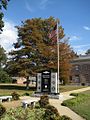 Veterans Memorial
 -
 Post office
 -
 Courthouse
 -
 Memorial
 -
 Road sign
 -
 Main Street
 -
 Fire hall


References[edit]
- ^ "2020 U.S. Gazetteer Files". United States Census Bureau. Retrieved July 24, 2022.
- ^ "Find a County". National Association of Counties. Retrieved June 7, 2011.
- ^ Jews of Early Mississippi, University Press of Mississippi, pp. 77, 78
- ^ "Lynched Negro, Condemned Deed". The New York Times. September 27, 1913.
- ^ "Websites are FREE at vistaprint.com/websites". Poorpeoplescampaignppc.org. Archived from the original on March 30, 2014. Retrieved May 2, 2017.
- ^ "Mississippi Delta town welcomes new Amtrak train stop". WREG-TV. May 5, 2018. Retrieved May 6, 2018.
- ^ "Zipcode 38646 - Marks, Mississippi Hardiness Zones". www.plantmaps.com. Retrieved July 31, 2021.
- ^ "Census of Population and Housing". Census.gov. Retrieved June 4, 2015.
- ^ "Explore Census Data". data.census.gov. Retrieved December 17, 2021.
- ^ "U.S. Census website". United States Census Bureau. Retrieved January 31, 2008.
- ^ Home. Delta Academy. Retrieved on April 8, 2012. "1150 Riverside Drive Marks, MS 38646"
- ^ "Valley Queen Missionary Baptist Church". Quitman County, Mississippi. March 1, 2016.
External links[edit]
Municipalities and communities of Quitman County, Mississippi, United States | ||
|---|---|---|
| Cities |  | |
| Towns | ||
| CDPs | ||
| Other unincorporated communities | ||
| Ghost towns | ||
| Footnotes | ‡This populated place also has portions in an adjacent county or counties | |
| International | |
|---|---|
| National | |