
Lorinčík
Lorinčík | |
|---|---|
Borough | |
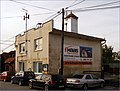
 Street and housing in a part of Lorinčík | |
 Flag  Coat of arms | |
 Location within Košice | |
| Country | Slovakia |
| Region | Košice |
| District | Košice II |
| Village | 1248 (first written record) |
| Borough | 1991 (current form) |
| Area | |
| • Total | 2.97 km2 (1.15 sq mi) |
| Elevation | 365 m (1,198 ft) |
| Population (31 December 2020) | |
| • Total | 888 |
| • Density | 300/km2 (770/sq mi) |
| Postal code | 040 11 |
| Area code | +421-55 |
| Car plate | KE |
| Website | www.lorincik.eu |
| Source [1] | |
Lorinčík (Hungarian: Szentlőrincke) is a borough (city ward) of Košice, Slovakia. Lorinčík is located in the Košice II district, at an altitude of roughly 302 metres (991 ft) above sea level. It is one of the westernmost boroughs of Košice and retains its traditionally rural character.
History[edit]

The first written records of Lorinčík date as far back as 1248, when the local area and settlement was known as Gord. The settlement and its name had fallen out of use by the early 16th century, with the name Lorinčík replacing it since the 16th century. The name of the village originated from the chapel, which was dedicated to Saint Lawrence.[2] In the 18th century, Lorinčík was possibly abandoned, as it's missing from most records from the period, though it reemerges again as a settled place by 1808. In the mid-1800s, it's noted as a mostly Slovak village. Lorinčík became a borough of Košice in the 20th century and has had its own municipal government since 1991.
The current Church of St Lawrence in the borough, a protected landmark, was built in 1932. However, the patronage of St Lawrence for the locality dates back to at least the early modern period, when an older chapel or church dedicated to St Lawrence already stood in the area. The etymology of Lorinčík (derived from "Lawrence") seems to be based on the traditional use of this specific patron saint in the former village. The borough's current official name in Hungarian is Szentlőrincke ("Little St. Lawrence") and its historical Hungarian name was Lőrincke.
Evolution of the borough's name[edit]
- 1406 – Zenthlewrench
- 1426 – predium Zenthlewryncz alio nomine Felgard
- 1427 – predium Zenthlewrincz alio nomine Felgard
- 1553 – Zenthlorincz
- 1808 – Lořinčík, Lořinček (Slovak) Lőrinczke (Hungarian)
- 1863—1895 – Lőrincke
- 1898—1913, 1938—1945 Szentlőrincke
- 1906 – slovensky: Ľorinčík
- 1920—1938, 1945 – Lorinčík
Statistics[edit]
- Area: 2.97 square kilometres (1.15 sq mi)
- Population: 888 (31 December 2020)
- Population density: 298/km² (31 December 2020)
- District: Košice II
- Mayor: Damián Exner (as of 2018 elections)
Gallery[edit]
-
 The Church of St. Lawrence in Lorinčík
 -
 The Church of St. Lawrence in Lorinčík
 -
 Local cemetery in Lorinčík
 -
 A street in the borough, leading uphill to the church
 -
 Local fire brigade station
 -
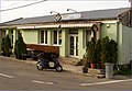 Local pub in Lorinčík
 -
 Public bus route terminus


References[edit]
- ^ Mestská a obecná štatistika SR (urgently needs an updated statistics link for 2018) Archived 2007-04-27 at the Wayback Machine
- ^ "História".
External links[edit]
- Official website of the Lorinčík borough
- Article on the Lorinčík borough at Cassovia.sk
- Official website of Košice
48°41′N 21°12′E / 48.683°N 21.200°E
| International | |
|---|---|
| National | |