
Войти
| Бат-энд-Уэллсская епархия | |
|---|---|
 | |
| Местоположение | |
| Церковная провинция | Кентербери |
| Архидиаконрис | Бат, Уэллс, Тонтон |
| Статистика | |
| Приходы | 477 |
| Церкви | 569 |
| Информация | |
| Собор | Собор Церковь Святого Андрея |
| Текущее руководство | |
| Епископ | Питер Хэнкок, Епископ Бата и Уэллса |
| Суффраган | Рут Уорсли, Епископ Тонтона |
| Архидьяконы | Саймон Хилл, архидьякон Тонтона. Энн Гелл, архидьякон Уэллса. Адриан Юингс, архидьякон Бата |
| Веб-сайт | |
| bathandwells.org.uk | |
Церковные приходы в пределах Бат и Уэллс покрывают большую часть английского графа y из Сомерсет и небольшие районы Девон, Дорсет, Глостершир и Уилтшир. епископская резиденция епископа Бата и Уэллса находится в соборной церкви Святого Андрея в городе Уэллс в Сомерсете. Епархиальные офисы, офисы и резиденции епископов и собор расположены вокруг Епископского дворца в Уэллсе. Епархия не упоминается как «Батская епархия» или «Веллсская епархия», а как «Батская и Веллсская епархия». Ординарным епархией является епархиальный епископ Бата и Уэллса, Питер Хэнкок ; ему помогает епископ-суфраган Тонтона, Рут Уорсли, чей престол был создан в 1911 году. Альтернативный епископский надзор (для приходов в епархии, которые отвергают служение священников кто женщины) предоставлен провинциальным епископальным посетителем (PEV), епископом-суфраганом Эббсфлита, Джонатаном Гудоллом, имеющим лицензию почетного помощника епископа епархии, чтобы облегчить его работу там.
приход со своей местной приходской церковью является основной единицей англиканской церкви. Приход в структуре англиканской церкви имеет свои корни в римско-католической церкви и пережил Реформацию в значительной степени нетронутой. Приходы англиканской церкви в настоящее время находятся в пределах одной из 44 епархий, разделенных между провинциями Кентербери с 30 епархиями и Йорк с 14. В 2017 г. всего около 12 600 приходов англиканской церкви, из которых 477 входят в эту епархию. Каждый приход управляется приходским священником, которому может помогать в его пастырских обязанностях викарий или викарии, которые также являются рукоположенными, но не приходскими священниками. Размер приходов и количество верующих сильно различаются. Приходской священник может нести ответственность за один приход, за два или более, а некоторые из них являются частью группового служения. В более широком смысле термин приход относится не только к территориальной единице, но и к людям его общины или конгрегации. бенефициар или живущий в англиканской церкви описывает любой церковный приход или группу церковных приходов, находящихся под одним стипендиатом служителем. Держатель бенефициара пожизненно владеет «безусловным правом собственности » на должность (церковь и дом пастора). До 19 века приходы также были самой маленькой территорией для местного самоуправления и административных функций. В соответствии с Законом о местном самоуправлении 1894 года гражданские обязанности церкви были упразднены и были созданы отдельные гражданские приходы. В результате различных потребностей гражданского сообщества и церкви во многих случаях границы церковных приходов и эквивалентных им гражданских приходов со временем расходились.
Архидьяконство охватывает большинство из двух унитарные органы власти Северного Сомерсета и Бата и Северо-Восточного Сомерсета, а также включают участки соседних районов в Сомерсете и Уилтшире. Архидьякон Бата - Адриан Юингс.
Деканат в основном находится в Бате и Северо-Восточном Сомерсете, но включает в себя один гражданский приход в Уилтшире и небольшой участок в Южном Глостершире. Помимо города Бат, он также включает окружающие пригороды города и соседние деревни.
Охватываемая территория включает Чу-Вэлли и прилегающие районы. Деканат в основном находится в пределах Бата и Северо-Восточного Сомерсета, а также включает часть Северного Сомерсета, Мендип и Седжмур. Часть области находится в пределах Мендип-Хиллз Района выдающейся природной красоты. Большая часть сельской местности находится в пределах Бристоля и Зеленого пояса Бат.
Деканат Замка охватывает Уэстон-сьюпер-Мэр и окрестные деревни. В основном он находится в пределах Северного Сомерсета, но включает части Мендип и Седжмур.
Деканат охватывает Мидсомер Нортон, Радсток и окрестные деревни, которые составляли часть Сомерсет Коулфилд. Территория разделена между районами местного самоуправления Бат и Северо-Восточный Сомерсет и Мендип.
The deanery covers the coastal towns of Portishead and Clevedon and the surrounding area. It is wholly within North Somerset.
Архидьяконство сосредоточено в Тонтоне и охватывает запад Сомерсета. Он также включает небольшие разделы Девон и Дорсет. Архидьякон Тонтона - Саймон Хилл.
Деканат охватывает области Южного Сомерсета, включая Крюкерн и Северный Перротт со многими окрестными деревнями. Некоторые приходы находятся прямо за границей графства в Западном Дорсете.
Деканат занимает большие площади из Эксмур в Уэст-Сомерсете. Население невелико и сосредоточено вокруг небольших городов и деревень.
Благочиние охватывает деревни в Южном Сомерсете и Тонтон Дин, а также один приход в Западном Дорсете и небольшая часть Восточного Девона.
The deanery covers parishes in Sedgemoor and West Somerset.
The deanery covers areas of Sedgemoor around Bridgwater, and the easternmost part of Taunton Deane.
The deanery covers the area around Taunton. It is mostly within Taunton Deane and includes a small section of Sedgemoor.
The deanery covers parishes in the western half of Taunton Deane and part of West Somerset.
The archdeaconry covers the majority of Mendip, the eastern halves of Sedgemoor and South Somerset, as well as small sections in neighbouring districts in Somerset, Dorset and Wiltshire. Wells Cathedral is within the geographic extent of the archdeaconry, but is excluded from it. The Archdeacon of Wells is Anne Gell.
The deanery is split between Sedgemoor and Mendip, and also includes one civil parish in North Somerset.
The deanery is mostly in South Somerset, but includes some civil parishes in Mendip and a small part of West Dorset.
The deanery covers areas of Mendip around Frome, with one parish which stretches into Wiltshire.
The deanery covers parishes in several districts around Glastonbury and Street on the Somerset Levels.
The deanery covers parishes in South Somerset.
The deanery covers parishes in the Mendip area.
The deanery includes parishes in South Somerset.
The area of central Wells, forming Wells St Andrew, a liberty around the cathedral and the Bishop's Palace is the only extra-parochial area within the diocese.
| Ecclesiastical parish | Benefice | Parish church | Location | Image | Civil parish(es) | District(s) |
|---|---|---|---|---|---|---|
| St Andrew Extra Parochial Place | None | None | 51°12′37″N 2°38′31″W / 51.2104°N 2.642°W / 51.2104; -2.642 (Wells St Andrew) | 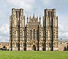 . Wells Cathedral . Wells Cathedral | Wells | Mendip |
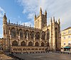 . Батское аббатство
 . Сент-Джон: Батвик
 . Сент-Мэри, Батвик
 . Сент-Майкл: Твертон
 . Церковь Комб-Хей
 . St Philip St James, Odd Down
 . Святой Михаил: Бат
 . Святой Варнава: Бат
 . Святой Петр: Инглишкомб
 . Святой Варфоломей, Бат
 . Святой Лука: Бат
 . Святой Спаситель: Бат
 . Сент-Мэри: Суэйнсуик
 . Сент-Суизин: Бат
 . Всех Святых: Бат
 . Св. Мэри: Лэнгридж
 . Сент-Мартин: Норт-Сток
 . Сент-Джон, Уэстон, Бат
 . Святой Николай: Келстон
 . Святой Томас в Беккете: Видкомб
 . Сент-Николас: Батхэмптон
 . Сент-Мэри: Клэвертон
 . Сент-Джон: Батистон
 . Сент-Суизин: Батфорд
 . Св. Стефана: Бат
 . Сент-Мэри: Чарлькомб
 . Святая Троица: Комб-Даун
 . Святой Михаил: Монктон Комб
 . Сент-Джеймс: Саут-Сток
 . Святой Иоанн: Хинтон Чартерхаус
 . Святой Андрей: Благдон
 . Святой Михаил: Комптон Мартин
 . Святой Батоломей: Ублей
 . Святой Андрей: Чу Магна
 . Сент-Майкл: Дандри
 . Святая Троица: Нортон Малруорд
 . Св. Мэри: Стэнтон Дрю
 . Сент-Эндрю: Чу-Сток
 . Святой Марии: Немпнет Трубвелл
 . Святая Троица: Епископ Саттон
 . Святой Августин Гиппопотам: Клаттон
 . Святые Николай и Святой Марии: Стоуи
 . Сент-Лоуренс: Ист-Харптри
 . Всех Святых: Фармборо
 . Святой Петр: Марксбери
 . Святой Лаврентия: Стэнтон Прайор
 . Сент-Джон: Кейншем
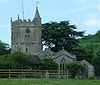 . Сент-Мэри: Комптон Дандо
 . Всех Святых: Паблоу
 . Всех Святых: Корстон
 . Святая Троица: Ньютон-Сент-Ло
 . Сент-Мэри: Солтфорд
 . Св. Катерина: Фелтон
 . Святой Марии и Святого Петра: Уинфорд
 . Сент-Эндрю: Банвелл
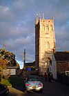 . Сент-Эндрю: Блидон
 . Святой Иоанн: Черчилль
 . Сент-Эндрю: Конгресбери
 . Сент-Мэри: Хаттон
 . Святой Августин: Блокировка
 . Сент-Пол: Кьюсток
 . Св. Петра и Св. Иуда: Милтон
 . Сент-Варнава: Уэстон-сьюпер-Мэр
 . Крайст-Черч, Уэстон-сьюпер-Мэр
 . Сент-Эммануэль: Уэстон-сьюпер-Мэр
 . Святой Иоанн: Уэстон-сьюпер-Мэр
 . Сент-Пол: Уэстон-сьюпер-Мэр
 . Сент-Джеймс: Уинскомб
 . Сен-Мартен: Уорл
 . Святая Троица: Беррингтон
 . Сент-Майкл: Баткомб
 . Всех Святых: Рингтон
 . St John: Chilcompton
 . St Vigor: Stratton-on-the-Fosse
 . Holy Trinity: Coleford
 . St Andrew:Holcombe
 . St Peter and St Paul: Kilmersdon
 . St John: Midsomer Norton
 . St John: Farrington Gurney
 . Holy Trinity: High Littleton
 . Holy Trinity: Paulton
 . St John: Peasedown St John
 . St Julian: Wellow
 . St Nicholas: Radstock
 . St Peter: Camerton
 . All Saints: Dunkerton
 . St Luke St Andrew: Priston
 . St Mary: Timsbury
 . St Peter: Westfield
 . Сент-Эндрю: Бэквелл
 . Сент-Бриджит: Челви
 . Церковь Христа: Клеведон
 . Сент-Эндрю: Клеведон
 . Святой Петр: Клеведон
 . Святой Иоанн: Клеведон
 . Святой Михаил: Клэптон в Гордано
 . Святой Павел: Уолтон в Гордано
 . Святой Марии: Уолтон Сент-Мэри
 . Святые Петра и Павла: Уэстон-ин-Гордано
 . Святой Марии и Святого Эдварда: Бэрроу Герни
 . Святой Михаил и все Ангелы: Лен Бортон
 . Всех Святых: Лонг Эштон
 . St Quiricus St Julietta: Tickenham
 . Святая Троица: Найлси
 . Святой Георгий: Истон в Гордано
 . Крайст-Черч : Pill
 . Сент-Мэри: Портбери
 . Святой Петр: Портисхед
 . Всех Святых: Рраксолл
 . Святая Троица: Клив
 . Сент-Мэри: Яттон
 . Святой Георгий: Хинтон-Сент-Джордж
 . Всех Святых: Лопен
 . AllSaints: Мерриот
 . Св. Петра и Св. Павла: Южный Петертон
 . Святой Батоломью: Крекерн
 . Святой Михаил: Хэзелбери Плакнетт
 . Сент-Джон: Сиборо
 . Сен-Мартен: Северный Перротт
 . Сент-Мэри: Баррингтон
 . Сент-Джеймс: Чиллингтон
 . Сент-Джеймс: Кадворт
 . Сент-Эндрю: Доулиш-Уэйк
 . Св. Иоанна: Кингстон
 . Сент-Эндрю: Пакингтон
 . Святой Михаил: Шептон Бошам
 . Святая Мария: Стоклинч
 . Святой Михаил: Алкомб
 . Сент-Мэри: Бромптон-Реджис
 . Святой Николай: Брашфорд
 . Всех Святых: Далвертон
 . Сент-Джон: Скилгейт
 . Сент-Джеймс: Аптон
 . Св. Иоанна: Кархэмптон
 . Святой Георгий: Данстер
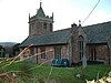 . Сент-Петрок: Тимберскомб
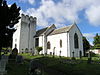 . Святой Николай: Уиткомб
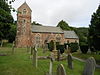 . Всех Святых: Вуттон-Куртенэ
 . Сент-Джон: Каткомб
 . Святой Марии: Эксфорд
 . Святой Лука: Симонсбат
 . Сент-Питер: Экстон
 . Сент-Джайлс: Хокридж
 . Сент-Мэри: Люксборо
 . Святой Марии: Уинсфорд
 . Сент-Эндрю: Витипул
 . Святой Михаил: Майнхед
 . Сент-Беуно: Калбоне
 . Сент-Джайлс: Лиленд
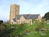 . Святой Андрей: Старый Клив
 . Сент-Питер: Треборо
 . Сент-Мэри: Люкомб
 . Святой Дубрикий
 . Всех Святых: Селуорти
 . Сент-Джеймс: Беркрокомб
 . Сент-Джеймс: Карри Маллет
 . Святой Иоанн: Хэтч Бошам
 . Сент-Майкл: Орчард Портман
 . Staple Fitzpaine
 . Сент-Мэри: Сток-Сент-Мэри
 . Сент-Эндрю: Вест-Хэтч
 . Добрый пастырь: Чард
 . Святая Мария: Чард
 . Святой Николай: Комб-Сент-Николас
 . Святой Марии: Вамбрук
 . Сент-Эндрю: Уайтстонтон
 . Сент-Томас: Крикет-Сент-Томас
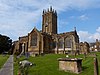 . Сент-Мэри: Илминстер
 . Св. Мэри: Уайтлэкингтон
 . Сент-Мэри: Эшилл
 . Санкт-Альдхельм и Санкт-Эдбург: Бродвей
 . Сент-Мэри: Доньятт
 . Сент-Джеймс: Хамбридж
 . Святой Петр: Хортон
 . Святой Петр: Илтон
 . Сент-Мэри: Айл-Эбботтс
 . Всех Святых: Остров Брюэрс
 . Сент-Мэри: Бакленд-Сент-Мэри
 . Св. Петра и Св. Павла: Черчстентон
 . Святой Николай: Корф
 . Святой Леонард: Оттерфорд
 . Сент-Эндрю и Сент-Мэри: Питминстер
 . Святой Михаил: Чаффкомб
 . Святой Марии: Крикет Малерби
 . Сент-Джон: Татворт
 . Сент-Мэри: Торнкомб
 . St Stephen: Winsham
 . All Saints: Aisholt
 . St Michael: Enmore
 . St Edward: Goathurst
 . St Mary: Nether Stowey
 . St Peter and St Paul: Over Stowey
 . St Margaret: Spaxton
 . St Mary: Cannington
 . St Peter: Combwich
 . St Mary: Stockland Bristol
 . St George: Bicknoller
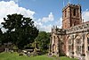 . Holy Ghost: Crowcombe
 . All Saints: Monksilver
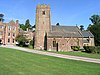 . St Mary: Nettlecombe
 . St George: Sampford Brett
 . St Mary: Stogumber
 . St Mary: East Quantoxhead
 . St Martin: Fiddington
 . St Mary: Holford
 . St Mary: Kilve
 . St Andrew: Stogursey
 . St Mary: Stringston
 . St Audries: West Quantoxhead
 . St Decuman: Watchet
 . St Peter: Williton
 . St John: Durston
 . St Peter: North Newton
 . St Mary: North Petherton
 . St Peter St John: Northmoor Green
 . St Giles: Thurloxton
 . Holy Trinity: Hamp
 . St Hugh: Durleigh
 . St John, Bridgwater
 . St Mary: Bridgwater
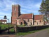 . Holy Trinity: Chilton Trinity
 . St John: Pawlett
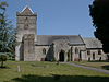 . St Michael: Puriton
 . St Michael: Burrowbridge
 . St Bartholomew
 . St Peter St Paul: North Curry
 . St Gregory: Stoke St Gregory
 . St George: Wembdon
 . St Mary: Chedzoy
 . St Mary: Westonzoyland
 . St Michael: Bawdrip
 . St Mary: Cossington
 . St Mary: Woolavington
 . St Peter and St Paul: Bishop's Hull
 . St Michael: Creech St Michael
 . St George: Ruishton
 . Holy Cross: Thornfalcon
 . St Michael: Galmington
 . St John: Taunton
 . St Mary: Taunton
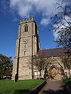 . All Saints: Norton Fitzwarren
 . St John: Staplegrove
 . Holy Trinity: Taunton
 . St Peter: Lyngford
 . St Andrew: Taunton
 . St James: Taunton
 . St Michael: Angersleigh
 . All Saints: Trull
 . St Mary All Saints: Broomfield
 . St Mary: Cheddon Fitzpaine
 . St Mary: Kingston St Mary
 . St Augustine: West Monkton
 . St George: Wilton
 . St Pancras: West Bagborough
 . St Mary: Bishops Lydeard
 . St Peter St Paul: Combe Florey
 . St Thomas: Cothelstone
 . St Lawrence: Lydeard St Lawrence
 . Holy Trinity: Ash Priors
 . St James: Fitzhead
 . St James: Halse
 . St Michael: Milverton
 . St John: Heathfield
 . Holy Cross: Hillfarrance
 . St Bartholomew: Oake
 . St John: Ashbrittle
 . St Bartholomew: Bathealton
 . St Giles: Bradford on Tone
 . St Nicholas: Kittisford
 . St Peter: Langford Budville
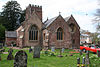 . All Saints: Nynehead
 . All Saints, Rockwell Green
 . St Peter and St Paul: Runnington
 . Holy Cross: Sampford Arunde
 . St Michael: Stawley
 . St Margaret: Thorne St Margaret
 . St John: Wellington
 . St Mary: West Buckland
 . St Mary: Brompton Ralph
 . All Saints: Chipstable
 . St Mary: Clatworthy
 . St Peter: Huish Champflower
 . St John: Tolland
 . St Andrew: Wiveliscombe
 . St John: Axbridge
 . St Michael and All Angels: Rowberrow
 . St Leonard: Shipham
 . St Bridget: Brean
 . St Bridget: Brean
 . St Michael: Brent Knoll
 . St Andrew: Burnham-on-Sea
 . St Andrew: Cheddar
 . St Leonard: Rodney Stoke
 . St Andrew: Compton Bishop
 . St John: Highbridge
 . All Saints: East Huntspill
 . St Peter: West Huntspill
 . Allerton Church: Chapel Allerton
 . St Mark: Mark
 . Holy Trinity: Blackford
 . Christ Church: Theale
 . St Mary: Wedmore
 . St Paul: Easton
 . St Lawrence: Westbury sub Mendip
 . St Mary: Abbas Combe
 . St Nicholas: Henstridge
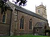 . St John: Horsington
 . St Mary: Batcombe
 . St John: South Brewham
 . St Mary: Bruton
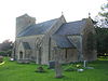 . St Mary and St John: Lamyat
 . St Leonard: Pitcombe
 . St Peter: Shepton Montague
 . St Mary: Upton Noble
 . St Andrew: Corton Denham
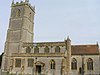 . St Barnabas: Queen Camel
 . St Mary: Sparkford
 . Holy Trinity: Sutton Montis
 . All Saints: West Camel
 . Holy Cross: Weston Bampfylde
 . St Michael: Blackford
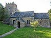 . St Nicholas: Bratton Seymour
 . St Mary: Compton Pauncefoot
 . St Nicholas: Holton
 . St Peter and St Paul: Maperton
 . St Michael: North Cadbury
 . St John: North Cheriton
 . Thomas Becket: South Cadbury
 . St Mary: Yarlington
 . St Andrew: Ansford
 . All Saints: Castle Cary
 . St Stephen: Charlton Musgrove
 . St Lawrence: Cucklington
 . St Andrew: Stoke Trister
 . St Peter: Evercreech
 . St James: Milton Clevedon
 . St Peter and St Paul: Charlton Horethorne
 . St Peter: Goathill
 . St John: Milborne Port
 . St Michael: Penselwood
 . All Saints: Alford
 . Holy Cross: Babcary
 . St Peter: Hornblotton
 . St Thomas: Lovington
 . St Nicholas: North Barrow
 . St Peter: South Barrow
 . St Peter and St Paul: Wincanton
 . St George: Beckington
 . St Mary: Berkley
 . All Saints: Lullington
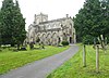 . Christ Church: Frome
 . St Mary: Frome
 . Holy Trinity: Frome
 . St John: Frome
 . St Mary: Hemington
 . St Giles: Leigh-on-Mendip
 . St Michael: Stoke St Michael
 . St Michael: Buckland Dinham
 . Holy Trinity, Chantry
 . St Mary: Great Elm
 . St Andrew: Mells
 . St George: Whatley
 . All Saints: Nunney
 . St Katherine: East Woodlands
 . St Dunstan: Baltonsborough
 . St Leonard: Butleigh
 . St Andrew: West Bradley
 . St Nicholas: West Pennard
 .
. . St John: Glastonbury
 . St Mary: Meare
 . St Michael All Angels: Greinton
 . Holy Cross: Middlezoy
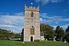 . St Mary: Moorlinch
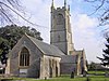 . St Michael: Othery
 . St Andrew: Compton Dundon
 . Holy Trinity: Street
 . Holy Trinity: Walton
 . St Edward: Chilton Polden
 . St David: Barton St David
 . St Mary: Keinton Mandeville
 . St Peter
 . St Andrew: Curry Rivel
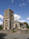 . St Martin: Fivehead
 . St Catherine: Swell
 . St Mary: Ilchester
 . St Mary: Limington
 . St Peter: Podimore
 . St Andrew: Aller
 . St Catherine: Drayton
 . St Andrew: High Ham
 . St Mary: Huish Episcopi
 . Christ Church, Long Load
 . Holy Trinity: Long Laod
 . St Peter and St Paul: Muchelney
 . St John: Pitney
 . Holy Trinity: Ash
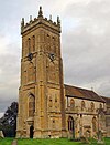 . St Martin: Kingsbury Episcopi
 . All Saints: Martock
 . St Peter and St Paul: Chiselborough
 . St Margaret: Milddle Chinnock
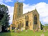 . St Mary: Norton-sub-Hamdon
 . St Mary: West Chinnock
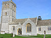 . All Saints: Kingsdon
 . St Michael and All Angels, Somerton
 . St Peter and St Paul, Charlton Adam
 . St Mary: Stoke-sub-Hamdon
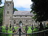 . St Janes: Ashwick
 . Holy Trinity: Binegar
 . St Mary: Chewton Mendip
 . St Mary: Litton
 . St Mary: Ston Easton
 . Christ Church: Coxley
 . Christ Church: Henton
 . St Matthew: Wookey
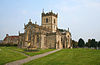 . St Mary: Ditcheat
 . All Saints: East Pennard
 . St Thomas: Pylle
 . St Mary: Croscombe
 . St Michael: Dinder
 . St Peter: North Wootton
 . St John: Pilton
 . St Aldhelm: Doulting
 . St Peter and St Paul: Shepton Mallet
 . St Cuthbert: Wells
 . St Mary: Wookey Hole
 . St Thomas: Wells
 . St Vincent: Ashington
 . St James, Chilton Cantelo
 . St Mary: Marston Magna
 . St Mary: Mudford
 . St Mary: Rimpton
 . St Andrew: Brympton
 . St Peter St Paul: Lufton
 . St Catherine: Montacute
 . St Peter and St Paul: Odcombe
 . St James: Preston Plucknett
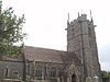 . All Saints: Closworth
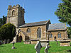 . St Mary: East Chinnock
 . St Michael: East Coker
 . St Mary: Hardington Mandeville
 . St Roch: Pendomer
 . All Saints: Sutton Bingham
 . St Martin: West Coker
 . St Mary, Chilthorne Domer
 . St Andrew: Thorne Coffin
 . St Margaret: Tintinhull
 . All Saints: Yeovil Marsh
 . St Mary, Barwick
 . St Michael: Yeovil
 . St John: Yeovil