Kutari River
| Kutari Cutari | |
|---|---|
 Armamatau, Kutari and Sipaliwini River, with Kutari as southern east border of the Tigri Area, map from 1930 | |
 | |
| Location | |
| Country | Guyana, Suriname |
| Physical characteristics | |
| Mouth | Coeroeni River |
• location | Sipaliwini River |
• coordinates | 2°20′32″N 56°52′4″W / 2.34222°N 56.86778°W |
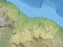
Kutari River, also called Cutari Rivier, Kutari Creek or Cutari Creek, is a small river on the southeastern border of Guyana and the southwestern region of Suriname. The location of the river is part of the disputed Tigri Area in the extreme South East region of Suriname.[1]
The river has its source in the Acarai Mountains that border Brazil.[2] Together with the Sipaliwini River the Kutari flows out in the Coeroeni River, where the village of Kwamalasamutu is within ten kilometers eastwards as the crow flies.[3] To the north, the Kutari and the Coeroenie successively form the rivers on the eastern border of the Tigri Area.[4] According to Guyana and the United Kingdom, this is the frontier of both countries; according to Suriname the border must be drawn at the New River.[2]
See also[edit]
References[edit]
- ^ Rand McNally, The New International Atlas, 1993
- ^ a b Ewan W. Anderson, International Boundaries: A Geopolitical Atlas, Guyana, page 37, ISBN 9781579583750, 2003
- ^ Dr. Eithne B. Carlin, Indianen in Suriname (in Dutch), Talen en Culturen van Indiaans Amerika (TCIA) / Leiden University Centre for Linguistics (LUCL)
- ^ Kevin H. De Cuba, Department for Sustainable Development (DSD) / The Organization of American States (OAS), Towards Sustainable Energy production and use in the lands inhabited by the Trio and Wayana peoples in the Suriname-Brazil border, 4.3.1 Micro hydro power in Kwamalasamutu, page 52, 2003 (in Dutch)
