
Войти
| Highway names | |
|---|---|
| Interstates | Interstate Highway X (IH-X, I-X) |
| US Highways | U.S. Highway X (US X) |
| State | State Highway X (SH X) |
| Loops: | Loop X |
| Spurs: | Spur X |
| Recreational: | Recreational Road X (RE X) |
| Farm or Ranch. to Market Roads: | Farm to Market Road X (FM X). Ranch to Market Road X (RM X) |
| Park Roads: | Park Road X (PR X) |
| System links | |
Farm to Market Roads in Texas are owned and maintained by the Texas Department of Transportation (TxDOT).
| |
|---|---|
| Location | San Saba County |
| Length | 22.279 mi (35.855 km) |
| Existed | July 13, 1945–present |
FM 500 was designated on July 13, 1945, from SH 16 northwestward 6.5 miles to Fairview. On November 23, 1948, FM 500 was extended northwest 4.4 miles. On September 29, 1954, FM 500 was extended northwest 4 miles. On August 24, 1955, FM 500 was extended west to FM 45, replacing FM 1479.
| |
|---|---|
| Location | Mason and San Saba counties |
| Length | 35.604 mi (57.299 km) |
| Existed | July 13, 1945–present |
Ranch to Market Road 501(RM 501) is a 35.6-mile Texas Ranch-to-Market road in Mason and San Saba Counties. Beginning at a junction with SH 71 in Pontotoc the road travels north and east to Cherokee then north and east to a junction with SW of Bend.
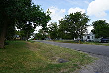
![]() RM 501 was authorized on July 13, 1945 as FM 501, a 3.4-mile road between SH 16 in Cherokee and the Salt Branch Road in San Saba County. On October 31, 1957, FM 501 was extendedwest to Pontotoc, replacing FM 1648, and FM 501 was changed to RM 501. On October 31, 1958, RM 501 was extended east 6 miles. On September 27, 1960, the road was extended to a junction with FM 580.
RM 501 was authorized on July 13, 1945 as FM 501, a 3.4-mile road between SH 16 in Cherokee and the Salt Branch Road in San Saba County. On October 31, 1957, FM 501 was extendedwest to Pontotoc, replacing FM 1648, and FM 501 was changed to RM 501. On October 31, 1958, RM 501 was extended east 6 miles. On September 27, 1960, the road was extended to a junction with FM 580.
| |
|---|---|
| Location | McCulloch and San Saba counties |
| Length | 16.013 mi (25.770 km) |
| Existed | July 14, 1945–present |
FM 502 was designated on July 14, 1945, from US 377 southeast and east 4 miles to the Milburn Road. On September 24, 1954, FM 502 was extended east to the end of FM 2048 at the McCulloch-San Saba County Line. Later that day, FM 2048 was cancelled and combined with FM 502.
| |
|---|---|
| Location | Coleman and McCulloch counties |
| Length | 48.023 mi (77.286 km) |
| Existed | July 14, 1945–present |
FM 503 was designated on July 14, 1945, from US 87 2.5 miles northwest of Melvin northward 7.4 miles to Salt Gap. On November 23, 1948, FM 503 was extended north 6.2 miles to Doole. On November 21, 1956, FM 503 was extended north 6 miles to. On September 27, 1960, FM 503 was extended north to US 67, replacing FM 566. On May 6, 1964, FM 503 was extended north to FM 53 (now SH 153 ). On May 7, 1974, FM 503 was extended north 2.4 miles to its current terminus.
| |
|---|---|
| Location | McCulloch County |
| Length | 14.458 mi (23.268 km) |
| Existed | July 14, 1945–present |
FM 504 was designated on July 14, 1945, from US 283 west and south 3.5 miles through Lohn to a point 5 miles east of Pear Valley. On July 21, 1949, FM 504 was extended west 2.8 miles. On May 23, 1951, FM 504 was extended west 3.2 through Pear Valley to a road intersection. On November 20, 1951, FM 504 was extended west 3.1 miles. On December 17, 1952, FM 504 was ext ended west 2 miles to FM 503.
| |
|---|---|
| Location | Jeff Davis County |
| Length | 8.827 mi (14.206 km) |
| Existed | July 9, 1945–present |
RM 505lies entirely within Jeff Davis County in the Trans-Pecos region of far West Texas. Intended to provide a link between the county's only two incorporated areas, Valentine and Fort Davis, RM 505 begins at a junction with US 90 south of Valentine and travels about 8.8 miles (14.2 km) east to an intersection with SH 166 approximately 22 miles (35 km) west of Fort Davis.
| |
|---|---|
| Location | Willacy and Cameron counties |
| Length | 19.763 mi (31.805 km) |
| Existed | July 3, 1945–present |
| |
|---|---|
| Location | Cameron and Willacy counties |
| Length | 14.451 mi (23.257 km) |
| Existed | July 3, 1945–present |
Farm to Market Road 507(FM 507) is located in Cameron and Willacy counties. It runs from Business US 77 to FM 498.
FM 507 was designated on July 3, 1945 from FM 106 northeast of Harlingen north 2.7 miles to the Combes/Rio Hondo Road (later FM 508). On July 12, 1949 the road was extended 3.2 miles north and east to a road intersection (later FM 498). Five months later the road was extended 2.5 miles east, but this section was reassigned to FM 1599 on June 18, 1950. On February 6, 1953 a break was added at FM 508. On October 31, 1957 the road was extended north 5 miles to FM 1018. On August 28, 1958 the northern terminus was moved to FM 498, forming a continuous route with FM 2374 and FM 509 was then extended over FM 2374, replacing it. On July 1, 1959 the road was extended south 1.3 miles over former FM 106 to US 77 (later Loop 448, now Business US 77). On June 27, 1995 the section from FM 508 to Business US 77 was transferred to UR 507, but this was ch вернулся к FM 507 15 ноября 2018 г.
| |
|---|---|
| Местоположение | Округ Кэмерон |
| Длина | 9,054 мили (14,571 км) |
| Существовал | 3 июля 1945 г. - настоящее время |
От Фермы до Маркет-Роуд 508 (FM 508 ) находится в округе Камерон. Он проходит от US 77 в Combes до FM 106 к западу от Rio Hondo.
FM 508 был назначен 3 июля 1945 года из точки в 6,5 милях к востоку от Комбеса до FM 106 к западу от Рио-Хондо. 17 декабря 1952 года дорога была продлена на 6,2 мили на запад до US 77, создавая параллелизм с FM 507. Этот параллелизм был удален 6 февраля 1953 года, когда этот участок был переведен на FM 508. 21 мая 1979 года участок длиной 0,3 мили из Loop 448 (теперь Business US 77) в US 77 был переведен в SH 107.
| |
|---|---|
| Location | Cameron County |
| Length | 17,053 мили (27,444 км) |
| Существовало | 3 июля 1945 г. - настоящее время |
От Фермы до Маркет-Роуд 509 (FM 509 ) находится в округе Камерон. Он проходит от FM 508 до пункта государственной пограничной инспекции недалеко от границы с Мексикой.
FM 509 был назначен 3 июля 1945 года от US 83 к югу от Харлингена до Рангервилля и на юго-восток до бульвара Сэма Хьюстона, но маршрут был скорректирован так, чтобы заканчиваться на FM 675. 26 апреля 1989 года дорога была продлена. к югу в 3 милях от комплекса GSA на международном мосту Лос-Индиос, хотя этот участок официально не обозначался до 1994 года. 21 декабря 1994 года дорога была продлена на север до FM 508, заменив Loop 590 и создав параллелизм с FM 1595. На 27 июня 1995 г. участок от FM 1595 до US 77 был переведен на UR 509. 20 ноября 2014 г. дорога была продлена на восток на 0,4 мили до предложенного в то время пункта государственной пограничной инспекции. 15 ноября 2018 г. UR 509 был изменен обратно на FM 509.
| |
|---|---|
| Местоположение | Округ Кэмерон |
| Длина | 22,284 мили (35,863 км) |
| Существовал | 3 июля 1945 г. - настоящее время |
| |
|---|---|
| Location | Cameron County |
| Length | 9.223 mi (14.843 km) |
| Existed | July 3, 1945–present |
| |
|---|---|
| Location | Hunt County |
| Length | 13.040 mi (20.986 km) |
| Existed | June 25, 1945–present |
 FM 513 in Lone Oak
| |
|---|---|
| Location | Hunt and Rains counties |
| Length | 18.056 mi (29.058 km) |
| Existed | June 25, 1945–present |
Farm to Market Road 513(FM 513) is located in Hunt and Rains counties.
FM 513 was designated on June 25, 1945, from SH 24 (now SH 224) in Commerce via Campbell to US 69 in Lone Oak. On November 23, 1948, FM 513 was extended south 5.8 miles. On October 26, 1954, FM 513 was extended south to FM 35 (now SH 276 ), replacing FM 1974. On August 28, 1958, one section was transferred to Spur 178. On May 1, 1965, the section from FM 819 to Spur 178 was transferred to the new SH 50, as well as FM 819 itself.
| |
|---|---|
| Location | Rains and Wood counties |
| Length | 17.504 mi (28.170 km) |
| Existed | June 11, 1945–present |
| |
|---|---|
| Location | Rains and Wood counties |
| Length | 30.022 mi (48.316 km) |
| Existed | June 11, 1945–present |
| |
|---|---|
| Location | Ward County |
| Length | 11.095 mi (17.856 km) |
| Existed | June 11, 1945–present |
| |
|---|---|
| Location | Brazoria and Galveston counties |
| Length | 21.079 mi (33.923 km) |
| Existed | July 9, 1945–present |
Farm to Market Road 517(FM 517) is located in Brazoria and Galveston counties. It runs from SH 6 in Alvin to FM 146.
FM 517был назначен 9 июля 1945 года, от US 75 в районе Дикинсона на востоке до SH 146 в Сан-Леон, и US 75 в районе Дикинсон на запад до линии округа Бразория. Участок линии округа Дикинсон-Бразория был отменен 18 января 1946 года, а 20 июля 1948 года дорога была продлена на запад до Альта-Лома. 17 декабря 1952 года дорога была продлена на запад до SH 6 и длиной 4,8 мили. участок FM 517 был переведен на FM 646 (изначально этот участок планировался как FM 520). 28 октября 1953 года дорога была продлена на северо-восток до мыса Эдвардс. 21 сентября 1955 года дорога была продлена на запад от мыса Эдвардс до SH 146, а затем на запад и юг через Баклифф до FM 517 2 мая 1962 года, образуя круговой маршрут. Часть FM 3436-FM 517 была переведена в FM 3436 (частично теперь FM 646) 28 января 1982 г. 27 июня 1995 г., когда часть UR 646-Сан-Леон была передана в UR 517, но 15 ноября 2018 г., UR 517 снова стал частью FM 517.
| |
|---|---|
| Местоположение | Brazoria и Galveston округ |
| Длина | 25,568 миль (41,148 км) |
| Существовал | 21 июня 1945 г. - настоящее время |
От Фермы до Маркет-Роуд 518 (FM 518 ) находится в округах Бразория и Галвестон. Он работает от SH 288 до SH 146 / будущий SH 99.
FM 518 был назначен 21 июня 1945 года от US 59 (ныне Alt. US 90) на южной стороне Хьюстона к югу от округа Бразория. линия. 9 июля 1945 года дорога была продлена на юг и восток до Кемы через Пирленд и Лиг-Сити, но 18 января 1946 года участок линии США 75-Бразория был отменен, создав разрыв. Этот разрыв был закрыт 27 января 1949 года, когда был добавлен участок от Лиг-Сити до линии округа Бразориа. 16 января 1968 года восточная конечная остановка была перемещена, а маршрут FM 518 был изменен, заменив часть FM 1266. Старый маршрут был перенумерован FM 2094. 13 сентября 1984 года Alt. Часть US 90-FM 518 была перенесена на FM 865, а FM 518 перенаправлен на FM 3344, что было отменено. На June 30, 1995, when the entire route was transferred to UR 518, but on November 15, 2018 the route was changed back to FM 518. Retail construction between FM 518 and FM 521 in Pearland is coming soon in the near future.
| |
|---|---|
| Location | Galveston County |
| Length | 6.421 mi (10.334 km) |
| Existed | July 9, 1945–present |
Farm to Market Road 519(FM 519) is located in Galveston County. It runs from SH 6 in Hitchcock to Loop 197 (now Spur 197) in Texas City.
FM 519 was designated on July 9, 1945, from Hitchcock to US 75 near La Marque. On November 29, 1990, the road was extended east to Loop 197, replacing SH 341. On June 17, 1995, the entire route was transferred to UR 519, but on November 15, 2018, the route was changed back to FM 519.
| |
|---|---|
| Location | Hansford and Sherman counties |
| Length | 22.531 mi (36.260 km) |
| Existed | May 23, 1951–present |
Farm to Market Road 520(FM 520) is located in Hansford County and Sherman County. It runs from SH 207 near Spearman to FM 1060.
FM 520 was designated on May 23, 1951, from SH 117 (renumbered SH 15 on October 26, 1954, this portion of SH 15 transferred to SH 207 on September 1, 1965) west to. SH 117 was renumbered SH 15 on October 26, 1954. On September 21, 1955, FM 520 was extended west to FM 278 (this section transferred to SH 136 on November 21, 1963). On May 25, 1976, FM 520 was extended west to FM 1060, completing its current length.
| |
|---|---|
| Location | Galveston County |
| Existed | July 9, 1945–January 13, 1946 |
The first FM 520 was designated on July 9, 1945, from SH 6 at Alta Loma north to FM 517 between Dickinson and Alvin. The route was cancelled on January 13, 1946. FM 517 (now FM 646) was routed over FM 520 in 1948.
| |
|---|---|
| Location | Matagorda, Brazoria, Fort Bend and Harris counties |
| Length | 94.609 mi (152.258 km) |
| Existed | July 9, 1945–present |
Farm to Market Road 521(FM 521) is located in Southeast Texas. It runs from US 90A in Houston to SH 35 near Palacios. At nearly 95 miles, FM 521 is one of the longest farm-to-market roads in Texas.
FM 521 was designated on July 9, 1945, from SH 36 in Brazoria to SH 35 at Bailey's Prairie. On January 16, 1953, the road was extended southwest and west to SH 60 in Wadsworth, replacing FM 1090, FM 1469 and a portion of FM 524. On September 29, 1954, the road was extended to SH 35 near Palacios, replacing FM 460 and FM 1096. A month later the road was extended northeast to SH 288 (now BS 288-B). On September 21, 1955, the road was rerouted around Wadsworth; the old route was redesignated FM 2078. On October 24, 1956, a 1.3-mile section of FM 521 from Brazoria northeastward was transferred to SH 332. On December 14, 1981, the road was extended over a former routing of SH 288 to US 90A in Houston. The final change came on June 27, 1995, when the UR 2234-US 90A portion was transferred to UR 521. This portion was changed back to FM 521 on November 15, 2018.
| |
|---|---|
| Location | Brazoria County |
| Length | 4.828 mi (7.770 km) |
| Existed | July 9, 1945–present |
Farm to Market Road 522(FM 522) is located in Brazoria County. It runs from SH 36 near West Columbia to FM 1459.
FM 522 was designated on July 9, 1945, from SH 36, 2 miles southeast of West Columbia to Blacks Ferry. The only change to the route was on May 2, 1962, when the road was extended southwest to FM 1459.
| |
|---|---|
| Location | Brazoria County |
| Length | 25.777 mi (41.484 km) |
| Existed | July 9, 1945–present |
Farm toМаркет-роуд 523 (FM 523 ) находится в округе Бразориа. он работает от SH 288 в Freeport до FM 521. FM 523 был обозначен 9 июля 1945 года с SH 288 в Freeport до. 22 июля 1949 года FM 523 был расширен до SH 35, заменив FM 1091. 4 декабря 1961 года северная конечная остановка в Энглтоне была перенесена. 23 мая 1983 года старый адрес FM 523 на Даунинг-стрит был передан городу Энглтон. 29 сентября 1992 г. FM 523 был расширен до FM 521, заменив и FM 3507.
| |
|---|---|
| Местоположение | Округ Бразориа |
| Длина | 16,907 миль (27,209 км) |
| Существовало | 9 июля 1945 г. - настоящее время |
От фермы до Маркет-роуд 524 (FM 524 ) находится в Округ Бразориа. Он проходит от FM 1301 около Западной Колумбии до FM 521.
FM 524 был назначен 9 июля 1945 года, от Бразории через Суини до SH 35. 16 января 1953 года 6,1-мильный участок FM 524 был переведен в FM 521. 9 июня 1958 г. был добавлен раздел от FM 1301 до SH 35, заменивший FM 1089. Последнее изменение произошло 29 апреля 2012 г., когда дорога была изменена вокруг предприятия ConocoPhillips к северо-западу от Суини из соображений безопасности.
| |
|---|---|
| Местоположение | Округ Харрис |
| Длина | 7,057 миль (11,357 км) |
| Существовал | 21 июня, 1945 - настоящее время |
Ферма-Маркет-Роуд 525 (FM 525 ) находится в округе Харрис. Он проходит от I-45 на запад до I-69 / US 59 на северной стороне Хьюстона. Дорога известна как дорога Алдин-Бендер.
FM 525 был назначен 21 июня 1945 года из США 59, в 10 милях к северу от Хьюстона, к западу до США 75 (ныне I-45). 1 марта 1961 года восточная конечная остановка была перемещена на юг, чтобы соединиться с предполагаемой развязкой на Ли-роуд и США 59. 30 июня 1995 года весь маршрут был перенесен на UR 525. Окончательное изменение произошло 29 мая 2014 года., когда FM 525 was rerouted back to its 1945 configuration, while the old route following Lee Road was redesignated FM Spur 525 (FS 525). FM 525 was also extended east 0.3 mile to Marine Road. On November 15, 2018 the route was changed back to FM 525.
| |
|---|---|
| Location | Harris County |
| Length | 4.625 mi (7.443 km) |
| Existed | June 21, 1941–present |
Farm to Market Road 526(FM 526) is located in Harris County. It runs from I-10 to US 90 Business. The road is known locally as Maxey Road.
FM 526 was designated on June 21, 1941, as a spur from US 90 northeast of Houston south 6 miles to the Market Street Road. On November 19, 1952, the road was rerouted to end at SH 73 (now I-10). On September 18, 1961, the northern terminus was relocated to a new alignment of US 90, replacing FM 2613. The old route is now Oates Road. The final change came on June 27, 1995, when the entire route was transferred to UR 526. The route was changed back to FM 526 on November 15, 2018.
| |
|---|---|
| Location | Harris County |
| Existed | June 21, 1945–August 23, 1991 |
Farm to Market Road 527(FM 527) was a designation applied to a highway in Harris County. There is no highway currently using the FM 527 designation.
FM 527 was designated on June 21, 1945, from U.S. Highway 90 (US 90) northeast of Houston, west and north 6 miles (9.7 km) to a point near Dyersdale. This route followed what is now Liberty Road, Houston Road, Fields Street and Mesa Drive. On November 1, 1967, the southern terminus was relocated and FM 527 followed Mesa Drive for the entire route. By district request, FM 527 was canceled on August 23, 1991, and removed from the highway system; the portion from US 90 to the north Houston city limits was returned to the city of Houston; the remaining portion was returned to Harris County.
Majorintersections. The entire route was in Houston, Harris County.
| mi | km | Destinations | Notes | ||
|---|---|---|---|---|---|
| 0.0 | 0.0 | ||||
| 5.1 | 8.2 | Mesa Road north | End state maintenance at railroad tracks | ||
| 1.000 mi = 1.609 km; 1.000 km = 0.621 mi. | |||||
| |
|---|---|
| Location | Brazoria, Galveston and Harris counties |
| Length | 9.941 mi (15.998 km) |
| Existed | June 21, 1945–present |
Farm to Market Road 528(FM 528) is located in Harris, Galveston and Brazoria counties. It runs from in Alvin northeast to I‑45 in Webster.
FM 528 was designated on June 21, 1945, from US 75 (now I‑45) east to SH 146 at Seabrook. On January 16, 1953, the road was extended west to SH 35 (later Loop 409; now BS 35-C) north of Alvin, replacing FM 1461. The section from I-45 east to SH 146 was transferred to NASA Road 1 on January 27, 1965. On June 27, 1995, the route was transferred to UR 528. The final change was on March 25, 2010, when UR 528 was extended southwest to SH 6, however this section remains unbuilt. On November 15, 2018, the route was changed back to FM 528.
| County | Location | mi | km | Destinations | Notes |
|---|---|---|---|---|---|
| Brazoria | Alvin | 0.0 | 0.0 | ||
| 0.6 | 0.97 | ||||
| Galveston | Friendswood | 5.9 | 9.5 | ||
| Harris | Webster | 9.8 | 15.8 | Continues east as NASA Parkway toward NASA Road 1 | |
| 1.000 mi = 1.609 km; 1.000 km = 0.621 mi. | |||||
| |
|---|---|
| Location | Austin, Waller, and Harris counties |
| Length | 42.011 mi ( 67.610 km) |
| Existed | June 21, 1945–present |
Farm to Market Road 529(FM 529) is located in Austin, Waller, and Harris counties. It runs from US 290 near Houston to SH 159 in Bellville.
FM 529 was designated on June 21, 1945, from US 290, 10 miles (16 km) northwest of Houston, west 7 miles (11 km) to an oil field. This route remained unchanged until June 28, 1963, when it was extended west to the Waller County line. On May 6, 1964, the road was again extended west to FM 362. On June 1, 1965, a section from FM 362 west to FM 331 was added. On April 6, 1970, the road was extended to SH 159 at Bellville, replacing a section of FM 331. The final change was on June 27, 1995, when the US 290–SH 99 portion was transferred to UR 529. This portion was changed back to FM 529 on November 15, 2018.
| County | Location | mi | km | Destinations | Notes |
|---|---|---|---|---|---|
| Austin | Bellville | 0 | 0.0 | Western terminus | |
| | 6.9 | 11.1 | Western end of FM 331 concurrency | ||
| | 7.3 | 11.7 | Eastern end of FM 331 concurrency | ||
| Waller | | 14.5 | 23.3 | ||
| | 18.5 | 29.8 | Western end of FM 362 concurrency | ||
| | 21.5 | 34.6 | Eastern end of FM 362 concurrency | ||
| | 25.7 | 41.4 | |||
| Harris | | 33.7 | 54.2 | ||
| Houston | 40.5 | 65.2 | |||
| Jersey Village | 45.1 | 72.6 | Eastern terminus; interchange | ||
1.000 mi = 1.609 km; 1.000 km = 0.621 mi.
| |||||
| |
|---|---|
| Location | Lavaca and Jackson counties |
| Length | 42.899 mi (69.039 km) |
| Existed | July 9, 1945–present |
Farm to Market Road 530(FM 530) is located in Lavaca and Jackson Counties. It runs from US 90A to Future I-69/US 59 northeast of Edna.
FM 530 was designated on July 9, 1945, from US 90A (then SH 200) southeast 6 miles toward Vienna. On August 26, 1948, FM 530 was extended southeast 4.45 miles to Vienna. On January 27, 1950, the road extended southeast 8.4 miles. On May 23, 1951, the road extended southeast 3.2 miles to a road intersection. On November 20, 1951, the road extended southeast to the Lavaca-Jackson County line. On December 17, 1952, FM 530 was extended southeast to US 59, replacing FM 719. On July 25, 1960, the northern terminus of FM 530 was relocated.
| |
|---|---|
| Location | Lavaca County |
| Length | 20.490 mi (32.975 km) |
| Existed | July 9, 1945–present |
Farm to Market Road 531(FM 531) is located in Lavaca County. It runs from US 90A to Ezzell.
FM 531 was designated on July 9, 1945, from what was then Spur 27 at Sweet Home to Koerth. On November 20, 1946, the road was extended to three miles north of US 77, replacing Spur 27 and FM 534. The final change was on July 14, 1949, when the road was extended northwest to SH 200 (now US 90A) and east to its current end, replacing FM 959.
| |
|---|---|
| Location | Gonzales, Lavaca and Colorado counties |
| Length | 43.486 mi (69.984 km) |
| Existed | July 9, 1945–present |
| |
|---|---|
| Location | Lavaca and Gonzales counties |
| Length | 8.041 mi (12.941 km) |
| Existed | July 9, 1945–present |
| |
|---|---|
| Location | Bee, Live Oak and Jim Wells counties |
| Length | 28. 166 mi (45.329 km) |
| Existed | May 23, 1951–present |
| |
|---|---|
| Location | Lavaca County |
| Existed | July 9, 1945–November 20, 1946 |
The first FM 534 was designated on July 9, 1945, from US 77 at Spur 27 north three miles. FM 534 was cancelled on November 20, 1946, and became a portion of FM 531.
| |
|---|---|
| Location | Bastrop County |
| Length | 33.425 mi (53.792 km) |
| Existed | July 9, 1945–present |
| |
|---|---|
| Location | Atascosa and Wilson counties |
| Length | 22.431 mi (36.099 km) |
| Existed | July 9, 1945–present |
Farm to Market Road 536(FM 536) is located in Atascosa and Wilson Counties. It starts at SH 97 US 181 in Floresville in the east, passes across Interstate 37, and terminates at US 281 just north of.
FM 536 was designated on July 9, 1945, from SH 97 (now Loop 181 ) in Floresville west 6 miles toward Fairview. On December 16, 1948, FM 536 was extended west 5.8 miles to Fairview. On December 17, 1952, FM 536 was extended west to US 281, replacing FM 1892. On October 23, 1965, FM 536 was extended east to US 181 and SH 97, completing its current route.
| |
|---|---|
| Location | Wilson County |
| Length | 13.070 mi (21.034 km) |
| Existed | July 9, 1945–present |
| |
|---|---|
| Location | Wilson County |
| Length | 3.267 mi (5.258 km) |
| Existed | July 9, 1945–present |
| |
|---|---|
| Location | Wilson and Guadalupe |
| Length | 19.936 mi (32.084 km) |
| Existed | July 9, 1945–present |
| |
|---|---|
| Location | Jones and Fisher counties |
| Length | 7.163 mi (11. 528 km) |
| Existed | December 13, 1956–present |
| |
|---|---|
| Location | Wilson County |
| Existed | July 9, 1945–November 21, 1956 |
The first FM 540 was designated on July 9, 1945, from SH 123 near the Guadalupe County line 3.5 miles towards Swift School. FM 540 was cancelled on November 21, 1956, and combined with FM 1681.
| |
|---|---|
| Location | Wilson County |
| Length | 35.382 mi (56.942 km) |
| Existed | July 9, 1945–present |
| |
|---|---|
| Location | Leon County |
| Length | 22.017 mi (35.433 km) |
| Existed | July 9, 1945–present |
| |
|---|---|
| Location | Collin County |
| Length | 10.093 mi (16.243 km) |
| Existed | July 9, 1945–present |
Farm to Market Road 543(FM 543) is located in Collin County. It runs from FM 455 at Weston to CR 206.
FM 543 was designated on July 9, 1945 from Anna to Weston and then to 1.5 miles east of Roland. On January 29, 1953 an 8.6 mile section was transferred to FM 455. On October 26, 1954 the road was extended south 2.7 miles to US 75 (now SH 5). FM 543 was cancelled on December 16, 2013; a 1.5 mile section from US 75 to CR 206 was removed altogether and the remaining 7.6 miles was redesignated as Spur 195, but this was changed back to FM 543 on September 26, 2016 and the section from US 75 to SH 5 was redesignated as Spur 195.
| |
|---|---|
| Location | Collin County |
| Length | 10.920 mi (17.574 km) |
| Existed | July 9, 1945–present |
Farm to Market Road 544(FM 544), known for most of its length as Parker Road, is a Farm to Market Road in Collin County, Texas that runs from State Highway 121 (SH 121) eastward to west Plano city limits, and from east Plano city limits to SH 78. FM544 проходит через города Плано, Мерфи и Уайли в округах Дентон и Коллин. Сегмент FM 544 в Плано проходит по Паркер-роуд, Плано-Паркуэй, Чарльз-стрит, Хеврон-Паркуэй, Парк-Бульвар, Койт-роуд, 15-й улице, G-авеню и 14-й улице. Он был изменен на Urban Road 544 (UR 544 ) 27 июня 1995 года Министерством транспорта Техаса, но 15 ноября 2018 года он был изменен обратно на FM 544.
Как и многие Дороги с фермы на рынок в метроплексе Даллас – Форт-Уэрт, здесь мало сельских районов из-за быстрого роста региона, хотя это было так, когда это было обозначено. Это полностью наземный маршрут, большая часть которого разделена проезжей частью.
FM 544 был назначен 9 июля 1945 года из SH 78 в Уайли до Плано. 23 ноября 1948 года FM 544 был продлен на запад до SH 289 в Шептоне. 20 ноября 1951 года FM 544 был продлен на запад до SH 121, заменив FM 1383. 24 ноября 1959 года FM 544 был продлен на юг до линии округа Даллас. 6 января 1978 г. участок от FM 544 от FM 3412 к югу до существующего FM 544 был переведен в FM 1378, а участок FM 544 с FM 1378 на SH 78 был перенумерован как FM. 3412. Старый FM 3412 стал изменением маршрута FM 544. 28 октября 1987 года участок FM 544 в Плано был передан городу Плано, создав разрыв на шоссе. 28 июля 1994 г. FM 544 был расширен на запад от старого SH 121 (ныне FM 2281 ) до нынешнего SH 121. 27 июня 1995 г. FM 544 был внутренне обозначен как UR 544. 31 августа В 2000 году участок FM 544 от SH 78 до линии округа Даллас был удален из системы шоссе штата и передан городу Уайли. 15 ноября 2018 года UR 544 был изменен обратно на FM 544.
| Округ | Местоположение | mi | km | Пункты назначения | Примечания |
|---|---|---|---|---|---|
| Дентон | Льюисвилл | 0.0 | 0.0 | ||
| 0.3 | 0,48 | ||||
| Collin | Plano | 6.9 | 11.1 | ||
| 8.9 | 14.3 | ||||
| 13.9 | 22.4 | US 75 exit 29 | |||
| Murphy | 19.8 | 31.9 | |||
| Wylie | 22.2 | 35.7 | |||
| 23.7 | 38.1 | ||||
| 1.000 mi = 1.609 km; 1.000 km = 0.621 mi. | |||||
| |
|---|---|
| Location | Collin County |
| Length | 11.077 mi (17.827 km) |
| Existed | July 9, 1945–present |
| |
|---|---|
| Location | Collin County |
| Length | 11.182 mi (17.996 km) |
| Existed | July 9, 1945–present |
| |
|---|---|
| Location | Collin County |
| Length | 7.876 mi (12.675 km) |
| Existed | July 9, 1945–present |
Farm to Market Road 547begins at an intersection with Farm to Market Road 6 in Nevada. The highway runs north along Moore Street to County Road 850 and turns to the west. FM 547 runs west until Farm to Market Road 1778 and turns back to the north. FM 547 ends at an intersection with U.S. Route 380 just east of Farmersville.
FM 547 was designated on July 9, 1945 on its current route.
The entire route is in Collin County.
| Location | mi | km | Destinations | Notes | |
|---|---|---|---|---|---|
| Josephine | 0.0 | 0.0 | |||
| | 2.6 | 4.2 | |||
| | 7.9 | 12.7 | |||
| 1.000 mi = 1.609 km; 1.000 km = 0.621 mi. | |||||
| |
|---|---|
| Location | Kaufman and Rockwall counties |
| Length | 23.284 mi (37.472 km) |
| Existed | July 9, 1945–present |
| |
|---|---|
| Location | Rockwall County |
| Length | 5.784 mi (9.308 km) |
| Existed | July 9, 1945–present |
FM 549runs from an intersection with Farm to Market Road 550 /Farm to Market Road 740 in Heath to State Highway 205 in southern Rockwall. FM 549 has a short overlap with SH 205. The highway ends at an intersection with State Highway 276. In Heath the highway is known as Buffalo Way and Hubbard Road.
FM 549 was designated on July 9, 1945, from US 67 (this section was redesignated as part of FM 7 on July 16, 1957, and FM 7 was redesignated as SH 66 on November 30, 1961) to SH 205. On June 1, 1965, FM 549 was extended southwest to FM 740. On May 25, 1976, FM 549 was extended north to FM 552. On September 24, 2009, the section from I-30 to SH 276 was given to the city of Rockwall, so the section north of I-30 was renumbered FM 3549.
The entire route is in Rockwall County.
| Location | mi | km | Destinations | Notes | |
|---|---|---|---|---|---|
| Heath | 0.0 | 0.0 | |||
| Heath –Rockwall line | 2.4 | 3.9 | Texas Health Presbyterian Rockwall | ||
| Rockwall | 3.7 | 6.0 | South end of SH 205 overlap | ||
| 4.0 | 6.4 | North end of SH 205 overlap | |||
| 4.4 | 7.1 | ||||
| 6.2 | 10.0 | ||||
| 1.000 mi = 1.609 km; 1.000 km = 0.621 mi. | |||||
| |
|---|---|
| Location | Rockwall County |
| Length | 10.151 mi (16.336 km) |
| Existed | July 9, 1945–present |
FM 550begins atan intersection with Farm to Market Road 549 /Farm to Market Road 740 in Heath. The highway runs east to McLendon-Chisholm where it intersects with State Highway 205. FM 550 runs north from SH 205 to State Highway 276, where FM 550 ends.
FM 550 was designated on July 9, 1945, from Rockwall, southward via Heath to SH 205. On November 4, 1955, the section north of FM 740 was transferred to FM 740, and FM 550 replaced a section of FM 548 northeast to FM 1143. On November 26, 1969, FM 1143 was cancelled and transferred to SH 276.
The entire route is in Rockwall County.
| Location | mi | km | Destinations | Notes | |
|---|---|---|---|---|---|
| Heath | |||||
| McLendon-Chisholm | |||||
| | |||||
| 1.000 mi = 1.609 km; 1.000 km = 0.621 mi. | |||||
| |
|---|---|
| Location | Rockwall County |
| Length | 3.400 mi (5.472 km) |
| Existed | July 9, 1945–present |
| |
|---|---|
| Location | Rockwall County |
| Length | 5.364 mi (8.633 km) |
| Existed | July 9, 1945–present |
| |
|---|---|
| Location | Freestone County |
| Length | 0.772 mi (1.242 km) |
| Existed | November 25, 1975–present |
Farm to Market Road 553(FM 553) is located in Freestone County. It runs from State Highway 179 to U.S. Route 84 in eastern Teague.
FM 553 was designated on November 25, 1975, on the current route.
The entire route is in Teague, Freestone County.
| mi | km | Destinations | Notes | ||
|---|---|---|---|---|---|
| 0.0 | 0.0 | ||||
| 0.8 | 1.3 | ||||
| 1.000 mi = 1.609 km; 1.000 km = 0.621 mi. | |||||
| |
|---|---|
| Location | Upshur County |
| Existed | July 13, 1945–June 2, 1967 |
The first FM 553 was designated on July 13, 1945, from SH 154, 1 mile west of Gilmer, northwest to Enon. On November 23, 1948, the road was extended to Grice. FM 553 was cancelled on June 19, 1967, and combined with FM 852. It was not signed as FM 852 until January 1, 1968.
| |
|---|---|
| Location | Ector County |
| Length | 7.212 mi (11.607 km) |
| Existed | October 26, 1983–present |
Farm to Market Road 554(FM 554) is located in Ector County. It runs from SH 158 in Gardendale to Loop 338.
FM 554 was designated on October 26, 1983, on the current route.
| |
|---|---|
| Location | Upshur County |
| Existed | July 13, 1945–August 3, 1971 |
The first FM 554 was designated on July 13, 1945, from SH 154 just west of Gilmer southwest to Latch. On November 20, 1961, the road was extended to FM 1002. FM 554 was cancelled on August 3, 1971, and transferred to FM 49 and FM 1795.
| |
|---|---|
| Location | Upshur County |
| Length | 10.862 mi (17.481 km) |
| Existed | July 13, 1945–present |
| |
|---|---|
| Location | Camp and Upshur counties |
| Length | 18.860 mi (30.352 km) |
| Existed | July 9, 1945–present |
| |
|---|---|
| Location | Camp and Upshur counties |
| Length | 16.929 mi (27.245 km) |
| Existed | July 9, 1945–present |
| |
|---|---|
| Location | Bowie County |
| Length | 5.883 mi (9.468 km) |
| Existed | July 9, 1945–present |
| |
|---|---|
| Location | Bowie County |
| Length | 11.214 mi (18.047 km) |
| Existed | July 9, 1945–present |
| |
|---|---|
| Location | Bowie County |
| Length | 4.929 mi (7.932 km) |
| Existed | July 9, 1945–present |
| |
|---|---|
| Location | Bowie County |
| Length | 11.473 mi (18.464 km) |
| Existed | May 23, 1951–present |
| |
|---|---|
| Location | Chambers County |
| Length | 22.564 mi (36.313 km) |
| Existed | July 9, 1945–present |
Farm to Market Road 562(FM 562) is located in Chambers County. It runs from SH 61/SH 65 south 10 miles, then southwest 15.9 miles to Smith Point.
FM 562 was designated on July 9, 1945, from the junction of SH 61 and SH 73T (now SH 65) south 10 miles to 2.6 miles south of Double Bayou. The only change was on January 27, 1950, when the road was extended southwest to Smith Point.
| |
|---|---|
| Location | Liberty and Chambers counties |
| Length | 27.545 mi (44.329 km) |
| Existed | June 12, 1945–present |
Farm to Market Road 564(FM 564) is a designation that has been used twice. There is no highway currently using the FM 564 designation.
| |
|---|---|
| Location | Chambers County |
| Existed | July 9, 1945–April 10, 1965 |
The original FM 564 was designated on July 9, 1945, from Anahuac south 4.1 miles (6.6 km) to Scherer. On September 27, 1960, FM 564 was to be relocated to the road from SH 61 FM 563 southward 4.0 miles (6.4 km). Construction on the new road was completed by April 10, 1965, which is the day that FM 564 was removed from the state highway system; it is now Main Street. The new road that was to become new FM 564 became part of FM 563 instead.
| |
|---|---|
| Location | Wood County |
| Length | 7.455 mi (11.998 km) |
| Existed | July 11, 1968–March 25, 2010 |
The next use of the FM 564 designation was on July 11, 1968, from US 69 northwest of Mineola south to US 80. On February 1, 1973, the road was extended around the city back to its northern terminus, forming a loop. FM 564 was cancelled on March 25, 2010, and transferred to Loop 564. Construction still has not been completed.
| |
|---|---|
| Location | Chambers County |
| Length | 15.470 mi (24.897 km) |
| Existed | July 9, 1945–present |
Farm to Market Road 565(FM 565) is located in Chambers County. It runs from SH 146 in Mont Belvieu to SH 146 in Baytown.
FM 565 was designated on July 9, 1945, from Mont Belvieu to 2 miles southeast of Winfree. The only change was on November 23, 1948, when the road was extended to SH 146 in Baytown. The section from Loop 207 west to SH 146 opened in 2019. Shortly after opening, the section of Loop 207 south of FM 565 was cancelled and removed from the state highway system.
| |
|---|---|
| Location | Ellis County |
| Length | 0.863 mi (1.389 km) |
| Existed | July 1, 1964–present |
Farm to Market Road 566(FM 566) is located in Ellis County. It runs from US 77 in Milford to I-35E.
FM 566 was designated on July 1, 1964, on the current route.
| |
|---|---|
| Location | Coleman County |
| Existed | July 18, 1945–October 14, 1960 |
The first FM 566 was designated on July 18, 1945, from US 67 in Valera south 6.2 miles to West Road 3.5 miles north of Voss. On July 15, 1949, the road was extended south 3.5 miles to Voss. On December 17, 1952, the road was extended south 4.3 miles to a road intersection. On April 25, 1960, the northern terminus was relocated. FM 566 was cancelled on October 14, 1960, and transferred to FM 503.
| |
|---|---|
| Location | Colem an County |
| Length | 3.465 mi (5.576 km) |
| Existed | July 18, 1945–present |
| |
|---|---|
| Location | Coleman County |
| Length | 12.323 mi (19.832 km) |
| Existed | July 18, 1945–present |
Farm to Market Road 568(FM 568) is located in Coleman County. It runs from SH 206 in Coleman to an intersection with County Roads 127 and 134.
FM 568 was designated on July 18, 1945, from US 84, 2 miles southeast of Coleman, east 4.5 miles to an intersection with Echo Road. The route description was changed on August 4, 1945 to go from US 84 east and south 4.5 miles. On January 27, 1948 the route was changed to go from US 84, 2.5 miles southeast of Coleman, east 5.3 miles. On November 23, 1948, the road was extended south to US 67/US 84 near Santa Anna. This section was renumbered as FM 1176 on April 13, 1949. On October 16, 1951, the road was extended east and northeast 3.6 miles to a road intersection, and extended northeast another 2.2 miles to a second road intersection on November 20, 1951. On October 24, 1955, the road was extended to SH 206, replacing Loop 175 (formerly SH 359).
| |
|---|---|
| Location | Eastland County |
| Length | 21.002 mi (33.799 km) |
| Existed | July 23, 1945–present |
| |
|---|---|
| Location | Eastland |
| Length | 11.395 mi (18.338 km) |
| Existed | July 23, 1945–present |
| |
|---|---|
| Location | Eastland County |
| Length | 19.202 mi (30.903 km) |
| Existed | July 23, 1945–present |
| |
|---|---|
| Location | Mills County |
| Length | 17.792 mi (28.633 km) |
| Existed | July 23, 1945–present |
| |
|---|---|
| Location | Comanche and Mills counties |
| Length | 32.796 mi (52.780 km) |
| Existed | July 23,1945–present |
| |
|---|---|
| Location | Mills County |
| Length | 23.227 mi (37.380 km) |
| Existed | July 23, 1945–present |
| |
|---|---|
| Location | Mills County |
| Length | 10.933 mi (17.595 km) |
| Existed | July 23, 1945–present |
| |
|---|---|
| Location | Shackelford and Stephens counties |
| Length | 40.231 mi (64.746 km) |
| Existed | July 21, 1945–present |
| |
|---|---|
| Location | Washington County |
| Length | 5.221 mi (8.402 km) |
| Existed | October 31, 1957–present |
Farm to Market Road 577(FM 577) is located in Washington County. It runs from SH 36, northwest of Brenham, east and southeast to US 290, southeast of Brenham, forming a partial loop. It is known locally as Gun and Rod Road and Blue Bell Road. Blue Bell Creameries is located on this road.
FM 577 was designated on October 31, 1957, from SH 36 (now BS 36-J) at Horton Street east to SH 90 (now SH 105). On June 28, 1963, the road was extended southeast to US 290. On July 25, 1993, the road was extended west to SH 36, bringing the highway to its current configuration.
| |
|---|---|
| Location | Stephens County |
| Existed | July 21, 1945–March 27, 1957 |
The first FM 577 was designated on July 21, 1945, from US 180, 4 miles east of Breckenridge southeast 8.5 miles to Necessity. On November 23, 1948, the road was extended southeast 2.7 miles, then southeast and east another 2.4 miles on July 15, 1949, and finally east 3.6 miles to FM 717 on September 15, 1955. FM 577 was cancelled on March 27, 1957, and transferred to FM 207.
| |
|---|---|
| Location | Young and Stephens counties |
| Length | 31.303 mi (50.377 km) |
| Existed | June 11, 1945–present |
| |
|---|---|
| Location | Leon and Madison counties |
| Length | 3.794 mi (6.106 km) |
| Existed | September 26, 1979–present |
Farm to Market Road 579(FM 579) is a designation that has been used three times. The current use dates from 1979 in Leon County.
FM 579 was designated on September 26, 1979, from FM 1119, 2.5 miles southeast of FM 977, south to the Madison County line. On October 21, 1981, the road was extended south to SH OSR.
| |
|---|---|
| Location | Stephens County |
| Existed | July 21, 1945–August 1, 1947 |
The first use of the FM 579 designation was in Stephens County, from SH 67, 9 miles south of Breckenridge, east 4.5 miles to the Wayland/Necessity Road. FM 579 was cancelled on August 1, 1947, and mileage was used by an extension of FM 701.
| |
|---|---|
| Location | Hale and Floyd counties |
| Length | 3.794 mi (6.106 km) |
| Existed | May 23, 1951–September 19, 1968 |
The second use of the FM 579 designation was in Floyd County on May 23, 1951, from US 62, 3 miles south of Floydada west 4.1 miles to a road intersection. On November 20, 1951, the road was extended west to FM 784 (now FM 378). A portion from FM 789 east to FM 378 was added on December 21, 1959, replacing a portion of FM 784 and creating a concurrency at FM 378. A section from FM 400 east to FM 789 was added on July 11, 1968, creating a concurrency at FM 789. FM 579 was cancelled on September 19, 1968, and combined with FM 37.
| |
|---|---|
| Location | San Saba, Lampasas, and Coryell counties |
| Length | 62.240 mi (100.166 km) |
| Existed | July 11, 1945–present |
| |
|---|---|
| Location | Lampasas County |
| Length | 31.608 mi (50.868 km) |
| Exist ed | June 11, 1945–present |
| |
|---|---|
| Location | Zavala County |
| Length | 12.747 mi (20.514 km) |
| Existed | October 31, 1958–present |
Farm to Market Road 582(FM 582) is located in Zavala County. It runs from FM 65 in Crystal City to FM 395. FM 582 is known locally as Lake Street, South 7th Avenue and Rock Quarry Road in Crystal City.
FM 582 was designated on October 31, 1958, from FM 65 at Crystal City east to FM 395 as a replacement of a section of FM 395 (which was rerouted on a new road to the south). On May 20, 1961, the road was extended east, north and west to FM 395. The final change was on August 1, 1962, when a section of FM 582 between FM 65 and FM 1433 was relocated to follow Lake Street, creating a concurrency with FM 1433.
| |
|---|---|
| Location | Lampasas and Coryell counties |
| Existed | July 14, 1945–March 27, 1957 |
The original FM 582 was designated on July 14, 1945, from US 190 in Lampasas northeast 8 miles to the Copperas Cove Road. On November 23, 1948, the road was extended northeast 4.8 miles to Rumley. On July 15, 1949, the road was extended northeast 5 miles to a road intersection near the Coryell County line. On October 26, 1954, the road was extended 1.6 miles northeast to FM 1113 at Topsey. FM 582 was cancelled on March 27, 1957, and transferred to FM 580.
| |
|---|---|
| Location | Eastland and Brown counties |
| Length | 12.847 mi (20.675 km) |
| Existed | July 16, 1945–present |
| |
|---|---|
| Location | Tom Green County |
| Length | 13.325 mi (21.445 km) |
| Existed | November 24, 1959–present |
Ranch to Market Road 584(RM 584) is located in Tom Green County. The highway was designated on November 24, 1959, running from Loop 306 north на восток до авеню N в Сан-Анджело. 28 июня 1963 года шоссе было продлено на юго-запад на 4,9 мили. 26 ноября 1969 года северная конечная остановка RM 584 была перенесена с авеню N на US 87 вдоль авеню Q и Knickerbocker Road. 25 мая 1976 года шоссе было продлено на юго-запад и юго-запад до US 277. 27 июня 1995 года участок 584 ринггитов от County Road 225 до US 87 / US 277 был переведен на Urban Road 584. 15 ноября 2018 года этот участок был изменен обратно на 584 ринггита.
RM 584 начинается на пересечении с US 277 к югу от Сан-Анджело. Шоссе тянется на запад примерно на милю, прежде чем повернуть на северо-запад. RM 584 проходит около регионального аэропорта Сан-Анджело, затем пересекает озеро Насворти и входит в пределы города Сан-Анджело. В Сан-Анджело, RM 584, известный как Knickerbocker Road, проходит через южную часть города. Между озером Насворти и кольцом 306 шоссе проходит через множество подразделений, а затем проходит через крупный торговый центр к северу от кольцевой дороги 306. К северу от кольцевой дороги 306 трасса RM 584 проходит к югу от Государственного университета Анджело и заканчивается на перекрестке. с US 87 / US 277.
Весь маршрут проходит в Tom Green County.
| Location | mi | km | Destinations | Примечания | |
|---|---|---|---|---|---|
| | 0,0 | 0,0 | |||
| Сан-Анджело | 11,0 | 17,7 | |||
| 13,5 | 21,7 | ||||
| 1.000 миль = 1.609 км; 1.000 км = 0,621 мили. | |||||
| |
|---|---|
| Местоположение | Округ Браун |
| Существовал | 16 июля 1945 г. - 20 ноября 1951 г. |
FM 584 был назначен 16 июля 1945 года, от US 84 на северо-востоке Зефира в 3,5 милях до дороги возле Драй Бланкет Крик в округе Браун. 23 мая 1951 года FM 584 был продлен на северо-восток на 4,9 мили до линии округа Команч. FM 584 был отменен 20 ноября 1951 года и объединен с FM 590.
| |
|---|---|
| Location | Coleman and Brown counties |
| Length | 30.860 mi (49.664 km) |
| Existed | July 16, 1945–present |
| |
|---|---|
| Location | Brown and Mills counties |
| Length | 33.423 mi (53.789 km) |
| Existed | July 16, 1945–present |
| |
|---|---|
| Location | Eastland and Comanche counties |
| Length | 21.700 mi (34.923 km) |
| Existed | July 13, 1945–present |
| |
|---|---|
| Location | Comanche County |
| Length | 7.279 mi (11.714 km) |
| Existed | July 13, 1945–present |
| |
|---|---|
| Location | Comanche County |
| Length | 4.292 mi (6.907 km) |
| Existed | July 13, 1945–present |
| |
|---|---|
| Location | Comanche and Brown counties |
| Length | 21.025 mi (33.836 km) |
| Existed | July 13, 1945–present |
| |
|---|---|
| Location | Comanche County |
| Length | 4.765 mi (7.669 km) |
| Existed | July 13, 1945–present |
| |
|---|---|
| Location | Wheeler County |
| Length | 30.097 mi (48.436 km) |
| Existed | July 9, 1945–present |
| |
|---|---|
| Location | Upshur County |
| Length | 7.009 mi (11.280 km) |
| Existed | July 13, 1945–present |
| |
|---|---|
| Location | Washington County |
| Length | 2.623 mi (4.221 km) |
| Existed | September 26, 1979–present |
Farm to Market Road 594(FM 594) is a designation that has been used four times. The current use is in Washington County, from FM 1948 northwest to Flat Prairie.
| |
|---|---|
| Location | Hale County |
| Existed | July 9, 1945–August 20, 1964 |
Th e first use of FM 594 was in Hale County on July 9, 1945, from FM 54, 8 miles west of US 87, northward 7.5 miles to Cotton Center. A portion from US 70, 2 miles west of Halfway southward 9 miles to a road intersection was added on April 4, 1949, replacing FM 1069 and creating a gap. This gap was closed on November 20, 1951. FM 594 was cancelled on August 20, 1964, and transferred to FM 179.
| |
|---|---|
| Location | Floyd County |
| Existed | July 11, 1968–October 29, 1968 |
The next use of the FM 594 designation was in Floyd County, from US 70 in Floydada east 0.9 miles along Price Street to SH 207. This second use was short-lived, as FM 594 was combined with FM 784 just three months later, though this FM 594 was not cancelled until it was built.
| |
|---|---|
| Location | Bell County |
| Existed | November 3, 1972–October 11, 1978 |
The third use of the FM 594 designation was in Bell County, from US 190, 1 mile west of I-35, south and east two miles to I-35 at Loop 121. FM 594 was cancelled on October 11, 1978, and combined with Loop 121.
| |
|---|---|
| Location | Cochran County |
| Length | 12.352 mi (19.879 km) |
| Existed | July 9, 1945–present |
| |
|---|---|
| Location | Bailey and Cochran counties |
| Length | 8.018 mi (12.904 km) |
| Existed | July 9, 1945–present |
| |
|---|---|
| Location | Cochran, Hockley and Lubbock counties |
| Length | 65.999 mi (106.215 km) |
| Existed | July 9, 1945–present |
| |
|---|---|
| Location | Kaufman County |
| Length | 2.600 mi (4.184 km) |
| Existed | October 26, 1983–present |
Farm to Market Road 598(FM 598) is located in Kaufman County. It runs from FM 1392 south east to SH 205 in Terrell. It was not opened until around 2011.
| |
|---|---|
| Location | Briscoe and Floyd counties |
| Existed | July 21, 1945–December 21, 1959 |
The first FM 598 was designated on July 21, 1945, from SH 86, 7 miles west of Silverton, south 6 miles. Between May 7 and June 2, 1948, an 11.3 mile section from Lockney north to Lone Star School was added, replacing FM 787 and creating a gap. The northern portion was extended south 2 miles on July 14, 1949, and the gap was closed on December 17, 1952. On October 31, 1958, the road was extended to Loop 75 in Lockney. FM 598 was cancelled on December 21, 1959, and transferred to FM 378.
| |
|---|---|
| Location | Briscoe and Motley counties |
| Length | 11.695 mi (18.821 km) |
| Existed | July 21, 1945–present |